Göhrde | |
|---|---|
Location of Göhrde (unincorporated area) within Lüchow-Dannenberg district _in_DAN.svg.png.webp) | |
 Göhrde 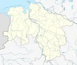 Göhrde | |
| Coordinates: 53°7′N 10°49′E / 53.117°N 10.817°E | |
| Country | Germany |
| State | Lower Saxony |
| District | Lüchow-Dannenberg |
| Area | |
| • Total | 51.92 km2 (20.05 sq mi) |
| Population (2021-12-31)[1] | |
| • Total | 0 |
| • Density | 0.0/km2 (0.0/sq mi) |
| Time zone | UTC+01:00 (CET) |
| • Summer (DST) | UTC+02:00 (CEST) |
Göhrde is an unincorporated area in the German district of Lüchow-Dannenberg, 51.92 km2 (20.05 sq mi) in size.[2] It contains large parts of the Göhrde State Forest and is unpopulated[2] - the villages of Kollase, Röthen and Zienitz are exclaves of the bordering municipality of Göhrde, not the unincorporated area. It is also bordered by Zernien, as well as the districts of Lüneburg and Uelzen.
References
Towns and municipalities in Lüchow-Dannenberg (district) | ||
|---|---|---|
Coat of arms | ||
| Unincorporated areas |
| |
This article is issued from Wikipedia. The text is licensed under Creative Commons - Attribution - Sharealike. Additional terms may apply for the media files.