K13 Fukuoka Airport Station 福岡空港駅 | |||||||||||
|---|---|---|---|---|---|---|---|---|---|---|---|
_Station_1.jpg.webp) Entrance No.1 | |||||||||||
| General information | |||||||||||
| Location | Shimousui, Hakata Ward, Fukuoka City, Fukuoka Prefecture Japan | ||||||||||
| Operated by | |||||||||||
| Line(s) | |||||||||||
| Platforms | 1 island platform | ||||||||||
| Tracks | 2 | ||||||||||
| Connections |
| ||||||||||
| Construction | |||||||||||
| Structure type | Underground | ||||||||||
| Other information | |||||||||||
| Station code | K13 | ||||||||||
| IATA code | FUK | ||||||||||
| History | |||||||||||
| Opened | 3 March 1993 | ||||||||||
| Passengers | |||||||||||
| 2007 | 20,053 daily[1] | ||||||||||
| Services | |||||||||||
| |||||||||||
| Location | |||||||||||
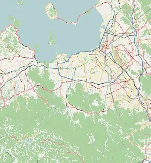
 K13 Fukuoka Airport Station Location within Fukuoka city  K13 Fukuoka Airport Station K13 Fukuoka Airport Station (Japan) | |||||||||||

Station sign (designed by Isao Nisijima)
Fukuoka Airport Station (福岡空港駅, Fukuokakūkō-eki, "Fukuoka Airport Station") is a Fukuoka City Subway station serving Fukuoka Airport in Fukuoka prefecture, Japan. The station symbol is a blue airplane and a cloud. This is the only subway station in Japan which directly connects with an airport.
History
The station opened on 3 March 1993.[2]
Lines
The station is served by the Fukuoka City Subway Kūkō Line.
Station layout
The platforms are located on the 2nd basement level.
| 1 | ■ Kūkō Line | for Hakata, Tenjin, Meinohama, Chikuzen-Maebaru and Karatsu |
| 2 | ■ Kūkō Line | for Hakata, Tenjin, Meinohama, Chikuzen-Maebaru and Karatsu |
 Ticket gates
 Platform
Vicinity
- Fukuoka Airport
- Terminal 1, 2, 3 and International Terminal
- Fukuoka Airport Police Station
- Fukuokakūkōnai Post Office
- Bus terminal (with. Airport Express bus)
- Higashihirao Park: Level-5 stadium
References
- ↑ 経営状況>運輸実績/福岡市交通局 Archived 13 August 2009 at the Wayback Machine (in Japanese)
- ↑ 地下鉄の概要/福岡市交通局 Archived 5 September 2009 at the Wayback Machine (in Japanese)
External links
- Fukuoka City Subway Fukuokakūkō Station information (in Japanese)
33°35′49.3872″N 130°26′54.9312″E / 33.597052000°N 130.448592000°E
This article is issued from Wikipedia. The text is licensed under Creative Commons - Attribution - Sharealike. Additional terms may apply for the media files.