Dorbod County | |
|---|---|
| 杜尔伯特蒙古族自治县 · ᠳᠥᠷᠪᠡᠳ ᠮᠣᠩᠭᠣᠯ ᠥᠪᠡᠷᠲᠡᠭᠡᠨ ᠵᠠᠰᠠᠬᠤ ᠰᠢᠶᠠᠨ Dorbod Mongol Autonomous County | |
 | |
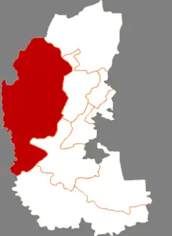 Dorbod in Daqing | |
.png.webp) Daqing in Heilongjiang | |
| Coordinates: 46°51′46″N 124°26′33″E / 46.8628°N 124.4426°E | |
| Country | China |
| Province | Heilongjiang |
| Prefecture-level city | Daqing |
| County seat | Dorbod Town (Taikang) |
| Area | |
| • Total | 6,427 km2 (2,481 sq mi) |
| Population (2020 census)[1] | |
| • Total | 199,293 |
| • Density | 31/km2 (80/sq mi) |
| Time zone | UTC+8 (China Standard) |
| Website | www |
| Dorbod Mongol Autonomous County | |||||||
|---|---|---|---|---|---|---|---|
| Chinese name | |||||||
| Simplified Chinese | 杜尔伯特蒙古族自治县 | ||||||
| Traditional Chinese | 杜爾伯特蒙古族自治縣 | ||||||
| |||||||
| Mongolian name | |||||||
| Mongolian script | ᠳᠥᠷᠪᠡᠳ ᠮᠣᠩᠭᠣᠯ ᠥᠪᠡᠷᠲᠡᠭᠡᠨ ᠵᠠᠰᠠᠬᠤ ᠰᠢᠶᠠᠨ | ||||||
Dorbod Mongol Autonomous County (Chinese: 杜尔伯特蒙古族自治县; Mongolian: ᠳᠥᠷᠪᠡᠳ ᠮᠣᠩᠭᠣᠯ ᠥᠪᠡᠷᠲᠡᠭᠡᠨ ᠵᠠᠰᠠᠬᠤ ᠰᠢᠶᠠᠨ) is a county in the west of Heilongjiang province, China, bordering Jilin province to the southwest. It is under the jurisdiction of the prefecture-level city of Daqing. The county is named after the Dörbed Mongols. It was known as Dorbod Banner (杜尔伯特旗) before 1956 and Taikang County (泰康县) during Republican period.
Administrative divisions
Dorbod Mongol Autonomous County is divided into 5 towns and 6 townships.[2]
| Name | Simplified Chinese | Hanyu Pinyin | Mongolian (Hudum Script) | Mongolian (Cyrillic) | Administrative division code |
|---|---|---|---|---|---|
| Towns | |||||
| Dorbod Town (Taikang) |
杜尔伯特镇 (泰康镇) |
Dù'ěrbótè Zhèn (Tàikāng Zhèn) |
ᠳᠥᠷᠪᠡᠳ ᠪᠠᠯᠭᠠᠰᠤ (ᠲᠠᠢ ᠺᠠᠩ ᠪᠠᠯᠭᠠᠰᠤ) |
230624100 | |
| Huzhultuhum Town (Hujitumo) |
胡吉吐莫镇 | Hújítǔmò Zhèn | ᠬᠣᠵᠤᠤᠯ ᠲᠥᠬᠥᠮ ᠪᠠᠯᠭᠠᠰᠤ | 230624101 | |
| Yantongtun Town | 烟筒屯镇 | Yāntǒngtún Zhèn | ᠶᠠᠨ ᠲᠦᠩ ᠲᠦᠨ ᠪᠠᠯᠭᠠᠰᠤ | 230624102 | |
| Talaha Town (Taliin Hiag) |
他拉哈镇 | Tālāhā Zhèn | ᠲᠠᠯᠠ ᠶᠢᠨ ᠬᠢᠶᠠᠭ ᠪᠠᠯᠭᠠᠰᠤ | 230624103 | |
| Lianhuanhu Town | 连环湖镇 | Liánhuánhú Zhèn | ᠯᠢᠶᠠᠨ ᠬᠤᠸᠠᠨ ᠬᠤ ᠪᠠᠯᠭᠠᠰᠤ | 230624104 | |
| Townships | |||||
| Yixin Township | 一心乡 | Yīxīn Xiāng | ᠢ ᠰᠢᠨ ᠰᠢᠶᠠᠩ | 230624200 | |
| Herstai Township | 克尔台乡 | Kè'ěrtái Xiāng | ᠬᠡᠷᠡᠰᠦᠲᠠᠢ ᠰᠢᠶᠠᠩ | 230624201 | |
| Aolinxibo Township (Oroigin Xibee) |
敖林西伯乡 | Áolínxībó Xiāng | ᠣᠷᠣᠢ ᠶᠢᠨ ᠰᠢᠪᠡᠭᠡ ᠰᠢᠶᠠᠩ | 230624203 | |
| Bayan Qagan Township (Bayanchagan) |
巴彦查干乡 | Bāyànchágān Xiāng | ᠪᠠᠶᠠᠨ ᠴᠠᠭᠠᠨ ᠰᠢᠶᠠᠩ | 230624204 | |
| Yaoxin Township (Dund Xin Ail) |
腰新乡 | Yāoxīn Xiāng | ᠳᠤᠮᠳᠠ ᠰᠢᠨᠡ ᠠᠢᠯ ᠰᠢᠶᠠᠩ | 230624205 | |
| Jiangwan Township | 江湾乡 | Jiāngwān Xiāng | ᠵᠢᠶᠠᠩ ᠸᠠᠨ ᠰᠢᠶᠠᠩ | 230624206 | |
Demographics
Climate
| Climate data for Dorbod (1991–2020 normals, extremes 1981–2010) | |||||||||||||
|---|---|---|---|---|---|---|---|---|---|---|---|---|---|
| Month | Jan | Feb | Mar | Apr | May | Jun | Jul | Aug | Sep | Oct | Nov | Dec | Year |
| Record high °C (°F) | −0.5 (31.1) |
9.4 (48.9) |
20.7 (69.3) |
31.8 (89.2) |
35.9 (96.6) |
40.5 (104.9) |
39.5 (103.1) |
36.1 (97.0) |
33.8 (92.8) |
27.1 (80.8) |
15.3 (59.5) |
5.8 (42.4) |
40.5 (104.9) |
| Mean daily maximum °C (°F) | −12.3 (9.9) |
−6.4 (20.5) |
2.7 (36.9) |
13.3 (55.9) |
21.5 (70.7) |
26.8 (80.2) |
28.6 (83.5) |
26.8 (80.2) |
21.2 (70.2) |
11.7 (53.1) |
−1.0 (30.2) |
−10.6 (12.9) |
10.2 (50.3) |
| Daily mean °C (°F) | −17.8 (0.0) |
−12.7 (9.1) |
−3.3 (26.1) |
7.3 (45.1) |
15.7 (60.3) |
21.5 (70.7) |
24.0 (75.2) |
22.0 (71.6) |
15.7 (60.3) |
6.4 (43.5) |
−5.7 (21.7) |
−15.4 (4.3) |
4.8 (40.7) |
| Mean daily minimum °C (°F) | −22.2 (−8.0) |
−18.0 (−0.4) |
−8.8 (16.2) |
1.5 (34.7) |
9.9 (49.8) |
16.3 (61.3) |
19.6 (67.3) |
17.8 (64.0) |
10.8 (51.4) |
1.8 (35.2) |
−9.6 (14.7) |
−19.3 (−2.7) |
0.0 (32.0) |
| Record low °C (°F) | −36.8 (−34.2) |
−32.6 (−26.7) |
−23.2 (−9.8) |
−10.6 (12.9) |
−0.8 (30.6) |
3.9 (39.0) |
12.0 (53.6) |
9.7 (49.5) |
−0.7 (30.7) |
−12.3 (9.9) |
−25.4 (−13.7) |
−32.2 (−26.0) |
−36.8 (−34.2) |
| Average precipitation mm (inches) | 1.4 (0.06) |
2.1 (0.08) |
5.2 (0.20) |
19.2 (0.76) |
32.9 (1.30) |
82.3 (3.24) |
134.6 (5.30) |
94.8 (3.73) |
44.6 (1.76) |
17.0 (0.67) |
4.1 (0.16) |
3.1 (0.12) |
441.3 (17.38) |
| Average precipitation days (≥ 0.1 mm) | 4.1 | 3.1 | 3.8 | 5.7 | 8.8 | 11.4 | 13.7 | 11.6 | 8.9 | 5.2 | 4.6 | 6.2 | 87.1 |
| Average snowy days | 6.8 | 5.0 | 5.4 | 2.7 | 0.2 | 0 | 0 | 0 | 0 | 2.1 | 6.2 | 8.5 | 36.9 |
| Average relative humidity (%) | 68 | 60 | 51 | 47 | 49 | 61 | 72 | 73 | 65 | 58 | 62 | 69 | 61 |
| Mean monthly sunshine hours | 176.8 | 206.8 | 251.6 | 235.7 | 246.9 | 234.1 | 226.1 | 224.8 | 226.8 | 209.4 | 170.9 | 153.4 | 2,563.3 |
| Percent possible sunshine | 64 | 71 | 68 | 57 | 52 | 49 | 47 | 52 | 61 | 63 | 62 | 59 | 59 |
| Source: China Meteorological Administration[4][5] | |||||||||||||
References
- ↑ "2020年大庆市第七次全国人口普查主要数据公报" (in Chinese). Daqing Municipal People's Government. 2021-06-01.
- ↑ "国家统计局" (in Chinese). National Bureau of Statistics of the People's Republic of China. Retrieved 2021-12-07.
- ↑ (in English) National Population Statistics Materials by County and City - 1999 Period, in China County & City Population 1999, Harvard China Historical GIS
- ↑ 中国气象数据网 – WeatherBk Data (in Simplified Chinese). China Meteorological Administration. Retrieved 27 September 2023.
- ↑ 中国气象数据网 (in Simplified Chinese). China Meteorological Administration. Retrieved 27 September 2023.
External links
- (in Chinese) Government site - Google translation
| Regions |
|  | |||||||
|---|---|---|---|---|---|---|---|---|---|
| Prefectures and counties |
| ||||||||
| |||||||||
This article is issued from Wikipedia. The text is licensed under Creative Commons - Attribution - Sharealike. Additional terms may apply for the media files.