Dolní Počernice | |
|---|---|
Municipal District of Prague Cadastral Area of Prague | |
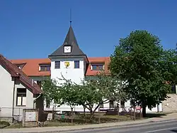 Dolní Počernice town hall | |
 Flag 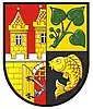 Coat of arms | |
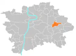 Location of Dolní Počernice in Prague | |
| Coordinates: 50°5′9″N 14°34′32″E / 50.08583°N 14.57556°E | |
| Country | Czech Republic |
| Region | Prague |
| District | Prague 14 |
| Government | |
| • Mayor | Zbyněk Richter |
| Area | |
| • Total | 5.76 km2 (2.22 sq mi) |
| Population (2021) | |
| • Total | 2,802 |
| • Density | 490/km2 (1,300/sq mi) |
| Time zone | UTC+1 (CET) |
| • Summer (DST) | UTC+2 (CEST) |
| Postal code | 190 12 |
| Website | http://www.praha-dolnipocernice.cz |
Dolní Počernice (German: Unter Potschernitz) is a municipal district (městská část) and cadastral area (katastrální území) in Prague. It is located in the eastern part of the city. As of 2021, there were 2,802 inhabitants living in Dolní Počernice.
The first written record of Dolní Počernice is from the 14th century. The village became part of Prague in 1974.
Demographics
| Year | Pop. | ±% |
|---|---|---|
| 1869 | 426 | — |
| 1880 | 522 | +22.5% |
| 1890 | 591 | +13.2% |
| 1900 | 649 | +9.8% |
| 1910 | 807 | +24.3% |
| 1921 | 853 | +5.7% |
| 1930 | 2,191 | +156.9% |
| 1950 | 2,334 | +6.5% |
| 1961 | 2,322 | −0.5% |
| 1970 | 2,102 | −9.5% |
| 1980 | 1,996 | −5.0% |
| 1991 | 1,780 | −10.8% |
| 2001 | 1,751 | −1.6% |
| 2011 | 2,247 | +28.3% |
| 2021 | 2,802 | +24.7% |
| Source: Censuses[1][2] | ||
References
- ↑ "Historický lexikon obcí České republiky 1869–2011 – Praha" (in Czech). Czech Statistical Office. 2015-12-21. pp. 7–8.
- ↑ "Population Census 2021: Population by sex". Public Database. Czech Statistical Office. 2021-03-27.
External links
Wikimedia Commons has media related to Dolní Počernice.
This article is issued from Wikipedia. The text is licensed under Creative Commons - Attribution - Sharealike. Additional terms may apply for the media files.