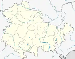
Dieterode | |
|---|---|
 Coat of arms | |
Location of Dieterode within Eichsfeld district  | |
 Dieterode  Dieterode | |
| Coordinates: 51°17′51″N 10°6′6″E / 51.29750°N 10.10167°E | |
| Country | Germany |
| State | Thuringia |
| District | Eichsfeld |
| Municipal assoc. | Ershausen/Geismar |
| Government | |
| • Mayor (2022–28) | Uwe Günther[1] |
| Area | |
| • Total | 2.79 km2 (1.08 sq mi) |
| Elevation | 403 m (1,322 ft) |
| Population (2022-12-31)[2] | |
| • Total | 80 |
| • Density | 29/km2 (74/sq mi) |
| Time zone | UTC+01:00 (CET) |
| • Summer (DST) | UTC+02:00 (CEST) |
| Postal codes | 37318 |
| Dialling codes | 036082 |
| Vehicle registration | EIC |
| Website | www.ershausen- geismar.de |

Dieterode is a municipality in the district Eichsfeld, Thuringia, Germany. It is part of the municipal association Ershausen/Geismar.
Situation
Dieterode, is situated eight kilometers south west of Heilbad Heiligenstadt between Höheberg and Rachelsberg. Neighbouring communities are Kalteneber (north east), Rüstungen, Schwobfeld (to the south) and Eichstruth (to the west).
History
The place is said to be firstly mentioned 1184 or 1251 as "Diethenroth".[3] The church, built in 1520, was newly built in 1785. In 1914, railway reached Dieterode. (Schwebda). Due to Inner German border closing, railway traffic ended in 1947. The rails were dismantled.
Demography
|
|
|
- Source: Thüringian Statistics Office
Politics
Community council
The Dieterode community council comprises 6 members.
The election proposal list of FFw (FFw = Voluntary Fire brigade) won all 6 seats (Date: 7. Juni 2009) [4]
Mayor
The (voluntary) mayor Uwe Günther (FFw) was first elected in 1994, and re-elected in 1999, 2004, 2010 and 2016.[5] [6]
Tourist attractions

- Catholic church „St. Georg“, built 1785
- Former railway station Dieterode; almost originally status
References
- ↑ Gewählte Bürgermeister - aktuelle Landesübersicht, Freistaat Thüringen, accessed 10 November 2022.
- ↑ "Bevölkerung der Gemeinden, erfüllenden Gemeinden und Verwaltungsgemeinschaften in Thüringen Gebietsstand: 31.12.2022" (in German). Thüringer Landesamt für Statistik. June 2023.
- ↑ "Verwaltungsgemeinschaft Ershausen/Geismar - Dieterode".
- ↑ Der Landeswahlleiter. "Kommunalwahlen in Thüringen am 7. Juni 2009. Wahlen der Gemeinde- und Stadtratsmitglieder. Vorläufige Ergebnisse" (PDF; 1,9 MB). Retrieved 10 March 2010.
- ↑ "Kommunalwahlen in Thüringen am 6. Juni 2010. Wahlen der Gemeinde- und Stadtratsmitglieder. Vorläufige Ergebnisse" (in German). Der Landeswahlleiter.
- ↑ Gemeinde: Dieterode, Thüringer Landesamt für Statistik