Didžioji Riešė | |
|---|---|
Village | |
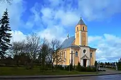 Church of Didžioji Riešė | |
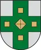 Coat of arms | |
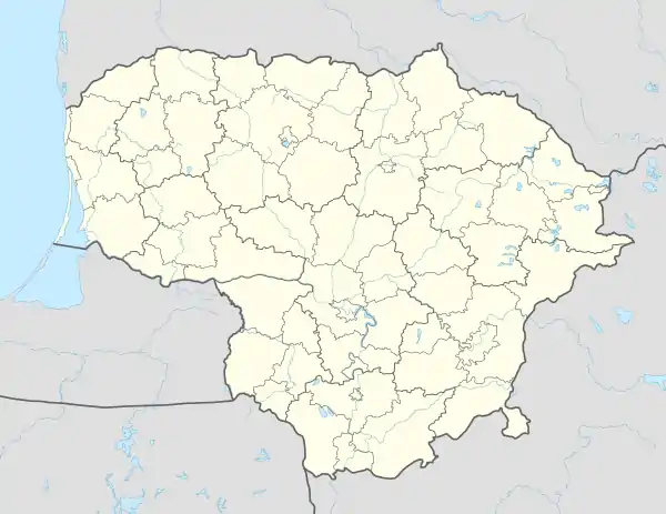 Didžioji Riešė Location of Didžioji Riešė | |
| Coordinates: 54°48′11″N 25°15′50″E / 54.80306°N 25.26389°E | |
| Country | |
| County | |
| Municipality | Vilnius District Municipality |
| Eldership | Riešė Eldership |
| Population (2011) | |
| • Total | 2,520 |
| Time zone | UTC+2 (EET) |
| • Summer (DST) | UTC+3 (EEST) |
.jpg.webp)
Fragment of Didžioji Riešė residential housing
Didžioji Riešė (Lithuanian pronunciation: [dʲɪ'd͡ʒʲɪoːjɪ rʲɪe'ʃʲeː]) is a village and administrative centre of Riešė eldership, Vilnius District Municipality, Lithuania. It is located only about 1 kilometre (0.62 mi) north-west of Vilnius city municipality, on the road Vilnius–Molėtai. At the 2011 census, the village had a population of 2,520.[1] That was an increase from the 2001 census which recorded the population of 1,142.[2]
History
During the Soviet occupation, it was a central settlement of a Soviet farm.[3]
In 2017, the official coat-of-arms was authorized.[4]
References
- ↑ "Gyventojai gyvenamosiose vietovėse". Statistics Lithuania. 2013-01-25. Archived from the original on 2017-02-02. Retrieved 2017-02-25.
- ↑ Vilniaus apskrities kaimo gyvenamosios vietovės ir jų gyventojai (PDF) (in Lithuanian). Vilnius: Department of Statistics to the Government of the Republic of Lithuania. 2003. p. 130. ISBN 9955-588-04-7. Archived from the original (PDF) on 2017-02-26. Retrieved 2017-03-26.
- ↑ "Didžioji Riešė". www.vle.lt (in Lithuanian). Retrieved 2021-01-06.
- ↑ "Didžioji Riešė". www.vle.lt (in Lithuanian). Retrieved 2021-01-06.

This article is issued from Wikipedia. The text is licensed under Creative Commons - Attribution - Sharealike. Additional terms may apply for the media files.