Curtil-Vergy | |
|---|---|
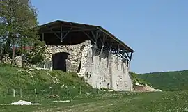 Ruin of the Saint-Vivant Abbey at Vergy | |
Location of Curtil-Vergy | |
 Curtil-Vergy 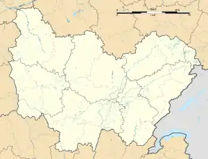 Curtil-Vergy | |
| Coordinates: 47°10′14″N 4°53′23″E / 47.1706°N 4.8897°E | |
| Country | France |
| Region | Bourgogne-Franche-Comté |
| Department | Côte-d'Or |
| Arrondissement | Beaune |
| Canton | Longvic |
| Intercommunality | Gevrey-Chambertin et Nuits-Saint-Georges |
| Government | |
| • Mayor (2020–2026) | Gilles Stunault[1] |
| Area 1 | 2.7 km2 (1.0 sq mi) |
| Population | 149 |
| • Density | 55/km2 (140/sq mi) |
| Time zone | UTC+01:00 (CET) |
| • Summer (DST) | UTC+02:00 (CEST) |
| INSEE/Postal code | 21219 /21220 |
| Elevation | 294–516 m (965–1,693 ft) |
| 1 French Land Register data, which excludes lakes, ponds, glaciers > 1 km2 (0.386 sq mi or 247 acres) and river estuaries. | |
Curtil-Vergy is a commune in the Côte-d'Or department in eastern France. It has an average population density of 51 people per km2, and an unemployment rate between 9.4 and 10.6%.[3] It is known for its hiking.[4]
Population
| Year | Pop. | ±% |
|---|---|---|
| 1962 | 38 | — |
| 1968 | 47 | +23.7% |
| 1975 | 60 | +27.7% |
| 1982 | 81 | +35.0% |
| 1990 | 78 | −3.7% |
| 1999 | 85 | +9.0% |
| 2008 | 111 | +30.6% |
| 2018 | 138 | +24.3% |
See also
References
- ↑ "Répertoire national des élus: les maires". data.gouv.fr, Plateforme ouverte des données publiques françaises (in French). 9 August 2021.
- ↑ "Populations légales 2021". The National Institute of Statistics and Economic Studies. 28 December 2023.
- ↑ "Curtil Vergy, Côte-d'Or (code postal 21..." www.linternaute.com. Retrieved 5 March 2022.
- ↑ "Top 8 Hikes and Walks around Curtil-Vergy". komoot. Retrieved 6 March 2022.
Wikimedia Commons has media related to Curtil-Vergy.
This article is issued from Wikipedia. The text is licensed under Creative Commons - Attribution - Sharealike. Additional terms may apply for the media files.