Csepreg | |
|---|---|
 | |
 Flag  Coat of arms | |
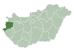
 Csepreg Location of Csepreg | |
| Coordinates: 47°24′01″N 16°42′21″E / 47.40022°N 16.70592°E | |
| Country | |
| County | Vas |
| Area | |
| • Total | 49.54 km2 (19.13 sq mi) |
| Population (2015)[1] | |
| • Total | 3,241 |
| • Density | 65/km2 (170/sq mi) |
| Time zone | UTC+1 (CET) |
| • Summer (DST) | UTC+2 (CEST) |
| Postal code | 9735 |
| Area code | 94 |
Csepreg (German: Schapring; Croatian: Čepreg) is a town in Vas County, Hungary. It is the largest town on the Répce River.[2] The current mayor of the town is Zoltán Horváth, elected on November 13, 2019.
Although tourism, particularly camping and fishing, are important sources of income for the town, a plan for the establishment of a metal finishing factory was accepted by the council after the first plan had been rejected.[3]
Education
- The town has a nursery, a kindergarten, an elementary school, a music school and a secondary school( Nádasdy Tamás Economic and IT Secondary School).
- The town library has a significant collection.
Notable people
- Miklós Takács de Saár, silviculturist, politician
- Antalovits Ferenc was born in Csepreg in 1953. He is a double European Championship bronze medalist and a four-time World Championship bronze medalist weight-lifter.
Sport
The football club of Csepreg was founded in 1924. The biggest achievement was winning the First Division of Vas County in the season of 1996/97. Currently the team is in the First Division of Vas County in the season of 2019/20, led by the coach, Zsolt Steiner.
Twin towns—sister cities
Csepreg is twinned with:
 Delnice, Croatia
Gallery
 Aerial photography of Csepreg
 Schöller Castle
 Main square—Széchenyi Square (detail)
 St. Nicholas Church
 St. Nicholas Church
 Inside the St. Nicholas Church
 Chapel of the Holy Spring
 The Fire Station of Csepreg
 Flag of Csepreg
 Lake Bene-hegy
References
- ↑ = 81322&p_temakor_kod = KSH&p_session_id = 800051036609396&p_lang = EN Gazetteer of Hungary, 1st January 2015. Hungarian Central Statistical Office.
- ↑ "Csepreg". Welcome to Hungary!. Compalmanach. Retrieved 2009-01-07.
- ↑ "Land use planning of a mixed industrial-dwelling area" (pdf). Participation Exercise. unece. Retrieved 2009-01-07.
External links
- Street map (in Hungarian)
This article is issued from Wikipedia. The text is licensed under Creative Commons - Attribution - Sharealike. Additional terms may apply for the media files.

