| Cropton | |
|---|---|
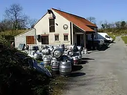
 Cropton Brewery in 2002 | |
.svg.png.webp) Cropton Location within North Yorkshire | |
| Population | 321 (2011 Census)[1] |
| OS grid reference | SE757891 |
| Unitary authority | |
| Ceremonial county | |
| Region | |
| Country | England |
| Sovereign state | United Kingdom |
| Post town | PICKERING |
| Postcode district | YO18 |
| Police | North Yorkshire |
| Fire | North Yorkshire |
| Ambulance | Yorkshire |
| UK Parliament | |
Cropton is a village and civil parish in the Ryedale district of North Yorkshire, England. It is on the border of the North York Moors National Park, 3 miles (5 km) north-west of Pickering.[2]
History
The village is mentioned in the Domesday Book as having three ploughlands, but it does not list any inhabitants.[3] The name of the village derives from Old English (cropp tūn), which means a swelling, mound or hill with a farmstead, settlement or village.[4] At the 2001 census, the parish (including Aislaby) had a population of 354,[5] decreasing to 321 (including Stape) at the 2011 Census.[1]
The Great Yorkshire Brewery, a microbrewery, is located to the rear of the New Inn on the edge of the village.[6] The owners of the pub started brewing their own beer in 1984, though beer had been brewed in the village as far back as 1613.[7] To the rear of the brewery is the site of a Motte-and-bailey castle, known as the Round Hill, which is scheduled ancient monument.[8]
Just outside the village and to the north, is the site of a set of Roman practice marching camps at Cawthorne, excavated by universities in recent years.[9] The camps are thought to be there as the village was on the route of a Roman Road between York and Dunsley Bay (Sandsend), on the Yorkshire Coast near to Whitby.[10] These have been registered as ancient monuments.[11] To the north of the village lies Cropton Forest, a 9,050-acre (3,660 ha) woodland that has a caravan park within it.[12] The forest is also noted for a programme to reintroduce beavers, which was successful in producing kits (baby beavers) in 2021.[13][14]
St Gregory's Church is a grade II listed structure, and whilst there is no accurate record of its building date, it was rebuilt in 1844.[15][16] In the churchyard is the base of a medieval cross. There is a poem and tradition associated with taking a drink and leaving money at the cross.[17][18]
Governance
An electoral ward in the same name exists. This ward stretches south to Normanby with a total population taken at the 2011 Census of 1,542.[19]
Notable people
- William Scoresby, Arctic whaler and navigator who sailed out of Whitby[20]
References
- 1 2 UK Census (2011). "Local Area Report – Cropton Parish (E04007567)". Nomis. Office for National Statistics. Retrieved 30 September 2021.
- ↑ "OL27" (Map). North York Moors - Eastern area. 1:25,000. Explorer. Ordnance Survey. 2016. ISBN 9780319242667.
- ↑ "Cropton". opendomesday.org. Retrieved 30 September 2021.
- ↑ Ekwall, Eilert (1960). The concise Oxford dictionary of English place-names (4 ed.). Oxford: Clarendon Press. p. 132. ISBN 0-19-869103-3.
- ↑ UK Census (2001). "Local Area Report – Cropton/Pickering (minor part of 2) Parish (36UF027)". Nomis. Office for National Statistics. Retrieved 30 September 2021.
- ↑ "VIP trips to brewery for £50,000". York Press. 26 December 2014. Retrieved 29 November 2017.
- ↑ Thomas, Peter (2005). Yorkshire's historic pubs. Stroud: Sutton Publishing. p. 37. ISBN 0750939834.
- ↑ Historic England. "Cropton Hall Garth: a motte and bailey castle including later medieval manor house, a medieval trackway and a pond (1011624)". National Heritage List for England. Retrieved 29 November 2017.
- ↑ "Cawthorn Roman Camps: North York Moors National Park". northyorkmoors.org.uk. Retrieved 29 November 2017.
- ↑ Frank, George (1888). Ryedale and North Yorkshire antiquities. London: E Stock. p. 223. OCLC 4986493.
- ↑ Historic England. "Cawthorn Roman forts and camp including a section of medieval trackway known as the Portergate (1007988)". National Heritage List for England. Retrieved 29 November 2017.
- ↑ "Cropton Forest". woodlandtrust.org.uk. Retrieved 30 September 2021.
- ↑ Perrin, Louise (7 July 2021). "Cropton Forest beaver trial welcomes two new additions to the family". The Scarborough News. Retrieved 30 September 2021.
- ↑ Wood, Alexandra (2 January 2021). "Forestry England confirms that Cropton Forest beavers have had fourth baby". The Yorkshire Post. Retrieved 30 September 2021.
- ↑ "St Gregory". www.achurchnearyou.com. Retrieved 30 September 2021.
- ↑ Historic England. "Church of St Gregory (Grade II) (1281522)". National Heritage List for England. Retrieved 30 September 2021.
- ↑ Mead, Harry (1978). Inside the North York Moors. Newton Abbot: David & Charles. p. 27. ISBN 0715376993.
- ↑ Historic England. "Stump of Churchyard Cross Approximately 20 Metres South of Church of St Gregory (Grade II) (1213520)". National Heritage List for England. Retrieved 30 September 2021.
- ↑ UK Census (2011). "Local Area Report – Cropton Ward (as of 2011) (E05006299)". Nomis. Office for National Statistics. Retrieved 30 September 2021.
- ↑ Laughton, J K. "Scoresby, William, senior". Oxford Dictionary of National Biography (online ed.). Oxford University Press. doi:10.1093/ref:odnb/24853. (Subscription or UK public library membership required.)