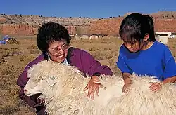
Cornfields, Arizona | |
|---|---|
 Cornfields Chapter House | |
 Cornfields | |
| Coordinates: 35°39′05″N 109°40′32″W / 35.65139°N 109.67556°W | |
| Country | United States |
| State | Arizona |
| County | Apache |
| Area | |
| • Total | 0.38 sq mi (0.97 km2) |
| • Land | 0.38 sq mi (0.97 km2) |
| • Water | 0.00 sq mi (0.00 km2) |
| Elevation | 6,152 ft (1,875 m) |
| Population (2020) | |
| • Total | 221 |
| • Density | 589.33/sq mi (227.52/km2) |
| Time zone | UTC-7 (MST) |
| • Summer (DST) | UTC-6 (MDT) |
| ZIP code | 86505[3] |
| Area code | 928 |
| FIPS code | 04-15850 |
| GNIS feature ID | 2582763[2] |
Cornfields is a chapter of the Navajo Nation and a census-designated place (CDP) in Apache County, Arizona, United States. The population was 255 at the 2010 census.[4]
Cornfields is part of the Fort Defiance Agency, of the Bureau of Indian Affairs; Ganado, AZ is the delegate seat for the district that encompasses the Jeddito, Cornfields, Ganado, Kinlichee, Steamboat communities at the Navajo Nation Council.
Geography

Cornfields is located about 10 miles (16 km) southwest of Burnside.
According to the United States Census Bureau, the CDP has a total area of 0.39 square miles (1.0 km2), all land.[4] Cornfields is part of the greater Ganado area which includes Ganado, Burnside, Cornfields, Kinlichee, Wood Springs, Klagetoh, and Steamboat and the family ranches dispersed amongst these sub-areas.
Education
It is in the Ganado Unified School District,[5] which operates Ganado High School.
Demographics
| Census | Pop. | Note | %± |
|---|---|---|---|
| 2020 | 221 | — | |
| U.S. Decennial Census[6] | |||
References
- ↑ "2020 U.S. Gazetteer Files". United States Census Bureau. Retrieved October 29, 2021.
- 1 2 U.S. Geological Survey Geographic Names Information System: Cornfields, Arizona
- ↑ "Cornfields AZ ZIP Code". zipdatamaps.com. 2023. Retrieved May 3, 2023.
- 1 2 "Geographic Identifiers: 2010 Demographic Profile Data (G001): Cornfields CDP, Arizona". U.S. Census Bureau, American Factfinder. Archived from the original on February 12, 2020. Retrieved April 18, 2013.
- ↑ "2020 CENSUS - SCHOOL DISTRICT REFERENCE MAP: Apache County, AZ" (PDF). U.S. Census Bureau. p. 3/4 (sheet 2). Retrieved January 13, 2022.
- ↑ "Census of Population and Housing". Census.gov. Retrieved June 4, 2016.
