Clay Township | |
|---|---|
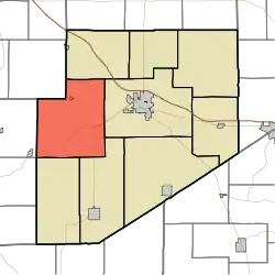 Location of Clay Township in Decatur County | |
| Coordinates: 39°18′46″N 85°37′09″W / 39.31278°N 85.61917°W | |
| Country | United States |
| State | Indiana |
| County | Decatur |
| Government | |
| • Type | Indiana township |
| Area | |
| • Total | 50.72 sq mi (131.4 km2) |
| • Land | 50.65 sq mi (131.2 km2) |
| • Water | 0.06 sq mi (0.2 km2) |
| Elevation | 830 ft (253 m) |
| Population (2010) | |
| • Total | 1,287 |
| • Density | 25.4/sq mi (9.8/km2) |
| FIPS code | 18-13042[2] |
| GNIS feature ID | 453208 |
Clay Township is one of nine townships in Decatur County, Indiana. As of the 2010 census, its population was 1,287 and it contained 535 housing units.[3]
History
Clay Township was organized in 1836.[4]
Champ's Ford Bridge was added to the National Register of Historic Places in 2009.[5]
Geography
According to the 2010 census, the township has a total area of 50.72 square miles (131.4 km2), of which 50.65 square miles (131.2 km2) (or 99.86%) is land and 0.06 square miles (0.16 km2) (or 0.12%) is water.[3]
Unincorporated towns
(This list is based on USGS data and may include former settlements.)
Adjacent townships
- Adams Township (northeast)
- Washington Township (east)
- Sand Creek Township (southeast)
- Jackson Township (south)
- Clifty Township, Bartholomew County (southwest)
- Haw Creek Township, Bartholomew County (west)
- Noble Township, Shelby County (northwest)
Major highways
Cemeteries
The township contains seven cemeteries: Center Grove, Columbia, Mowery, Nauvoo, Patrick, Pumphrey and Swinney.
References
- "Clay Township, Decatur County, Indiana". Geographic Names Information System. United States Geological Survey, United States Department of the Interior. Retrieved September 24, 2009.
- United States Census Bureau cartographic boundary files
- ↑ "US Board on Geographic Names". United States Geological Survey. October 25, 2007. Retrieved January 31, 2008.
- ↑ "U.S. Census website". United States Census Bureau. Retrieved January 31, 2008.
- 1 2 "Population, Housing Units, Area, and Density: 2010 - County -- County Subdivision and Place -- 2010 Census Summary File 1". United States Census. Archived from the original on February 12, 2020. Retrieved May 10, 2013.
- ↑ Harding, Lewis Albert (1915). History of Decatur County, Indiana: Its People, Industries and Institutions. B.F. Bowen. pp. 95.
- ↑ "National Register Information System". National Register of Historic Places. National Park Service. July 9, 2010.
External links
Wikimedia Commons has media related to Clay Township, Decatur County, Indiana.
Municipalities and communities of Decatur County, Indiana, United States | ||
|---|---|---|
| City | Map of Indiana highlighting Decatur County | |
| Towns | ||
| Townships | ||
| CDPs | ||
| Other communities | ||
| Ghost town | ||
| Footnotes | ‡This populated place also has portions in an adjacent county or counties | |
This article is issued from Wikipedia. The text is licensed under Creative Commons - Attribution - Sharealike. Additional terms may apply for the media files.