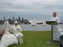

Clark Island is a small island in Sydney Harbour, near the coast of New South Wales, Australia. The island is part of the Sydney Harbour National Park and lies offshore the Sydney suburb of Darling Point, in the eastern part of Sydney Harbour between the Harbour Bridge and the harbour entrance.[1][2]

History and description
Clark Island is 0.9 hectares in area. Although the island is uninhabited, facilities include picnic tables, toilets, and drinking water. No ferry services operate to the island.[3]
The island derives its name from Lieutenant Ralph Clark, an officer of the First Fleet. In the early days of New South Wales, naval officers were allowed to keep their own vegetable gardens, which were tended by convicts. Clark established one such garden on the island, which was unsuccessful as any produce was soon stolen as a result of the limited rations available at the time. In February 1790, Clark noted that "some Boat had landed since I had been there last and taken away the greatest part ... it is impossible for any body to attempt to raise any Garden stuff here, before it comes to perfection they will steal it.[4]
In January 1979 a theatrical version of Robert Louis Stevenson's Treasure Island was performed on the island by the Nimrod Theatre Company as part of the Sydney Festival.[5]
See also
References
- ↑ Sydney Harbour National Park: Park Maps Archived 8 February 2007 at the Wayback Machine – NSW National Parks. Retrieved 9 September 2005.
- ↑ David Messent (1994). The Complete Guide to Sydney Harbour. ISBN 0-646-17888-1. Page 124.
- ↑ Sydney Harbour National Park: Venues for hire – NSW National Parks. Retrieved 18 November 2012.
- ↑ Hughes, Robert (1987). The Fatal Shore. New York City: Alfred A. Knopf. p. 97. ISBN 0-394-75366-6.
- ↑ "Event: Treasure Island". AusStage. Archived from the original on 5 May 2018. Retrieved 10 November 2022 – via National Library of Australia.
External links
- Catie Gilchrist (2014). "Clark Island". Dictionary of Sydney. Dictionary of Sydney Trust. Retrieved 6 October 2015. [CC-By-SA]
33°51′46″S 151°14′28″E / 33.86278°S 151.24111°E