Cipanas | |
|---|---|
 Cipanas Palace in around 1930 | |
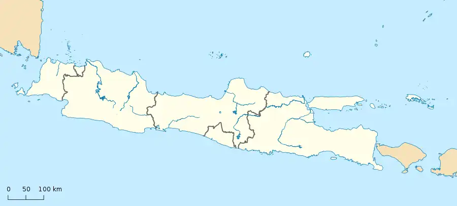 Cipanas Location in Java | |
| Coordinates: 6°43′37″S 107°02′37″E / 6.727012°S 107.043738°E | |
| Country | Indonesia |
| Province | West Java |
| Regency | Cianjur Regency |
| Area | |
| • Total | 67.28 km2 (25.98 sq mi) |
| Elevation | 1,000−1,200 m (−2,900 ft) |
| Highest elevation | 1,200 m (3,900 ft) |
| Lowest elevation | 1,000 m (3,000 ft) |
| Population (mid 2022 estimate)[1] | |
| • Total | 115,574 |
| • Density | 1,700/km2 (4,400/sq mi) |
| Time zone | UTC+7 (Indonesia Western Time) |
| Postal code | 43253[2] |
| Area code | (+62) 263 |
| Vehicle registration | F[3] |
Cipanas is a district in the extreme northwest corner of Cianjur Regency in West Java, Indonesia. It had an area of 67.28 km2 and a population of 103,911 at the 2010 Census.[4] which had increased to 113,592 at the 2020 Census;[1] the official estimate as at mid 2022 was 115,574.[5]
Administration
Cipanas consists of 7 villages[6] namely:
- Batulawang
- Ciloto
- Cimacan
- Cipanas
- Palasari
- Sindangjaya
- Sindanglaya
Climate
| Climate data for Cipanas, Cianjur, West Java, Indonesia (elevation 1,074 m or 3,524 ft) | |||||||||||||
|---|---|---|---|---|---|---|---|---|---|---|---|---|---|
| Month | Jan | Feb | Mar | Apr | May | Jun | Jul | Aug | Sep | Oct | Nov | Dec | Year |
| Mean daily maximum °C (°F) | 23.2 (73.8) |
23.2 (73.8) |
23.8 (74.8) |
24.1 (75.4) |
24.1 (75.4) |
23.9 (75.0) |
24.1 (75.4) |
24.7 (76.5) |
25.3 (77.5) |
24.9 (76.8) |
24.2 (75.6) |
23.6 (74.5) |
24.1 (75.4) |
| Daily mean °C (°F) | 19.5 (67.1) |
19.5 (67.1) |
19.7 (67.5) |
19.9 (67.8) |
20.1 (68.2) |
19.8 (67.6) |
19.7 (67.5) |
20.0 (68.0) |
20.3 (68.5) |
20.2 (68.4) |
20.0 (68.0) |
19.8 (67.6) |
19.9 (67.8) |
| Mean daily minimum °C (°F) | 17.1 (62.8) |
17.1 (62.8) |
17.0 (62.6) |
17.1 (62.8) |
17.0 (62.6) |
16.4 (61.5) |
15.9 (60.6) |
16.1 (61.0) |
16.4 (61.5) |
16.9 (62.4) |
17.3 (63.1) |
17.2 (63.0) |
16.8 (62.2) |
| Average precipitation mm (inches) | 342 (13.5) |
327 (12.9) |
334 (13.1) |
289 (11.4) |
164 (6.5) |
111 (4.4) |
94 (3.7) |
97 (3.8) |
129 (5.1) |
270 (10.6) |
376 (14.8) |
363 (14.3) |
2,896 (114.1) |
| Average relative humidity (%) | 88 | 89 | 88 | 87 | 86 | 82 | 77 | 73 | 72 | 77 | 85 | 87 | 83 |
| Mean daily sunshine hours | 6.6 | 6.3 | 7.0 | 6.9 | 7.2 | 7.6 | 7.8 | 8.1 | 8.4 | 8.0 | 7.4 | 7.3 | 7.4 |
| Source: https://en.climate-data.org/asia/indonesia/west-java/cipanas-601231/#climate-table | |||||||||||||
References
- 1 2 3 4 "Kecamatan Cipanas Dalam Angka 2019" (in Indonesian). Badan Pusat Statistik Kabupaten Cianjur. 26 September 2019. Retrieved 23 March 2021.
- 1 2 "Kode Pos Kecamatan Cipanas" (in Indonesian). Retrieved 23 March 2021.
- ↑ "Plat Nomor Kendaraan F dan Daftar Kode Belakangnya" (in Indonesian). Autobild. 6 February 2021. Retrieved 23 March 2021.
- ↑ Biro Pusat Statistik, Jakarta, 2011.
- ↑ Badan Pusat Statistik, Jakarta, 2023.
- ↑ "Daftar Nama Kecamatan Kelurahan/Desa & Kodepos Di Kota/Kabupaten Cianjur Jawa Barat (Jabar)" (in Indonesian). Retrieved 21 April 2014.
External links
 Media related to Cipanas, Cianjur at Wikimedia Commons
This article is issued from Wikipedia. The text is licensed under Creative Commons - Attribution - Sharealike. Additional terms may apply for the media files.