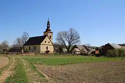
Chomiąża | |
|---|---|
 | |
 Chomiąża | |
| Coordinates: 50°6′33″N 17°39′46″E / 50.10917°N 17.66278°E | |
| Country | |
| Voivodeship | Opole |
| County | Głubczyce County |
| Gmina | Gmina Głubczyce |
| Time zone | UTC+1 (CET) |
| • Summer (DST) | UTC+2 (CEST) |
| Area code | +48 77 |
| Car plates | OGL |
Chomiąża [xɔˈmjɔ̃ʐa] is a village located in Poland, in the Opole Voivodeship, Głubczyce County and Gmina Głubczyce.
History
The present-day Polish village Chomiąża and the present-day Czech village Chomyž, directly across the Czech side of the border, were once a single village. After the Silesian Wars, the newly drawn border divided the village in two. The division continued through the Communist era of 1945–1990, and the border was not easily crossed until the two countries joined the Schengen Area in 2007.[1]
Location
The village is situated about 17 kilometres (11 mi) south-west of the centre of Głubczyce.
References
- ↑ "Special Locations". The Weekly Leaf (in German). 2019-03-27.
This article is issued from Wikipedia. The text is licensed under Creative Commons - Attribution - Sharealike. Additional terms may apply for the media files.
