Charny | |
|---|---|
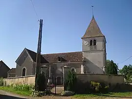 The church in Charny | |
 Coat of arms | |
Location of Charny | |
 Charny 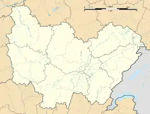 Charny | |
| Coordinates: 47°20′15″N 4°25′46″E / 47.3375°N 4.4294°E | |
| Country | France |
| Region | Bourgogne-Franche-Comté |
| Department | Côte-d'Or |
| Arrondissement | Montbard |
| Canton | Semur-en-Auxois |
| Government | |
| • Mayor (2020–2026) | Pascal Ripes[1] |
| Area 1 | 7.8 km2 (3.0 sq mi) |
| Population | 35 |
| • Density | 4.5/km2 (12/sq mi) |
| Time zone | UTC+01:00 (CET) |
| • Summer (DST) | UTC+02:00 (CEST) |
| INSEE/Postal code | 21147 /21350 |
| Elevation | 342–567 m (1,122–1,860 ft) (avg. 518 m or 1,699 ft) |
| 1 French Land Register data, which excludes lakes, ponds, glaciers > 1 km2 (0.386 sq mi or 247 acres) and river estuaries. | |
Charny (French pronunciation: [ʃaʁni] ⓘ) is a commune in the Côte-d'Or department in eastern France.
History
On 16 September 1911, Edouard Nieuport, racing pilot and airplane designer, dies a day after an airplane accident while landing at the Military Aerodrome in Charny in bad weather.
Population
| Year | Pop. | ±% |
|---|---|---|
| 1962 | 50 | — |
| 1968 | 51 | +2.0% |
| 1975 | 45 | −11.8% |
| 1982 | 42 | −6.7% |
| 1990 | 38 | −9.5% |
| 1999 | 34 | −10.5% |
| 2008 | 33 | −2.9% |
See also
References
- ↑ "Répertoire national des élus: les maires" (in French). data.gouv.fr, Plateforme ouverte des données publiques françaises. 13 September 2022.
- ↑ "Populations légales 2021". The National Institute of Statistics and Economic Studies. 28 December 2023.
Wikimedia Commons has media related to Charny (Côte-d'Or).
This article is issued from Wikipedia. The text is licensed under Creative Commons - Attribution - Sharealike. Additional terms may apply for the media files.