Chand
Chānd | |
|---|---|
Village | |
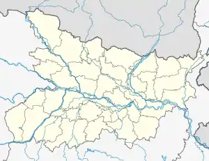 Chand Location in Bihar, India  Chand Chand (India) | |
| Coordinates: 25°06′54″N 83°23′46″E / 25.11501°N 83.39598°E[1] | |
| Country | India |
| State | Bihar |
| District | Kaimur |
| Area | |
| • Total | 4.50 km2 (1.74 sq mi) |
| Elevation | 85 m (279 ft) |
| Population (2011) | |
| • Total | 4,432[2] |
| Languages | |
| • Official | Bhojpuri, Hindi |
| Time zone | UTC+5:30 (IST) |
Chand is a village and corresponding community development block in Kaimur district, Bihar, India. As of 2011, its population was 4,432, in 700 households. The total block population was 133,682 in 20,413 households.[2]
Geography
Demographics
As of 2011, the sex ratio of Chand block was 921 females to every 1000 males. Among the 0-6 age group, the sex ratio was 934. Members of scheduled castes made up 21.5% of block residents and members of scheduled tribes made up 2.18%. The block's literacy rate was 67.25%, with 77.78% of men and 55.79% of women able to read and write.[2]
Most of Chand block's workforce was employed in agriculture in 2011, with 21.35% of workers being cultivators who owned or leased their own land and another 61.48% being agricultural labourers who worked someone else's land for wages. Another 5.35% of workers were household industry workers, and the remaining 11.81% were other workers.[2]
Villages
Chand block contains the following 137 villages:[2]
| Village name | Total land area (hectares) | Population (in 2011) |
|---|---|---|
| Biuri | 218 | 2,742 |
| Rebhanpur | 40 | 0 |
| Kalyanpur | 32 | 5 |
| Babhanpura | 65 | 0 |
| Rasulpur | 83 | 6 |
| Silauta | 192 | 1,466 |
| Birbhanpur | 144 | 1,283 |
| Narayanpur | 81 | 495 |
| Tikara | 143 | 202 |
| Shiv | 211 | 1,668 |
| Kishunpura | 87 | 626 |
| Naubant | 233 | 109 |
| Naukata | 112 | 245 |
| Chanos | 325 | 2,001 |
| Barahni | 136 | 436 |
| Kharanti | 146 | 782 |
| Paura | 211 | 943 |
| Sendura | 137 | 475 |
| Duguthua | 169 | 1,121 |
| Salaunja | 66 | 477 |
| Darabchak | 27 | 0 |
| Mohammadpur | 41 | 0 |
| Lasanri | 101 | 677 |
| Bhaluhari | 107 | 1,245 |
| Kuddi | 452 | 3,232 |
| Bhatani | 171 | 1,118 |
| Kuwadda | 240 | 621 |
| Khainti | 112 | 633 |
| Lanka | 65 | 0 |
| Goin | 420 | 3,445 |
| Jigana | 219 | 1,291 |
| Sihoria | 191 | 1,743 |
| Kariara | 96 | 65 |
| Barawan | 186 | 643 |
| Bheri | 113 | 771 |
| Auraiya | 85 | 70 |
| Majhgain | 82 | 243 |
| Majhgawan | 46 | 0 |
| Bhewar | 178 | 1,592 |
| Dhobaha Pachhim Patti | 54 | 462 |
| Dhobaha Purab Patti | 53 | 646 |
| Panrepur | 80 | 0 |
| Parei | 91 | 0 |
| Akauni | 173 | 1,239 |
| Karmapur | 58 | 459 |
| Babhniawan | 263 | 1,576 |
| Parhi | 412 | 2,673 |
| Chand (block headquarters) | 450 | 4,432 |
| Jhajhani | 270 | 676 |
| Konahra | 157 | 806 |
| Chakia | 64 | 0 |
| Kurhnu | 171 | 966 |
| Ichawan | 277 | 2,109 |
| Diwane | 158 | 924 |
| Pahraicha | 110 | 847 |
| Milki | 46 | 0 |
| Mohammadpur | 23 | 111 |
| Rajpur | 32 | 53 |
| Bharuhiya | 102 | 1,213 |
| Sirihra | 550 | 4,971 |
| Alipur | 36 | 400 |
| Ailae Khurd | 106 | 0 |
| Ailae Patna | 407 | 3,274 |
| Bahadura | 134 | 965 |
| Baghi | 47 | 106 |
| Ghatmapur | 49 | 0 |
| Parasia | 42 | 246 |
| Baghchhara | 85 | 604 |
| Digghi | 58 | 655 |
| Lakhopakar | 49 | 222 |
| Seha | 44 | 255 |
| Rampur Pathra | 109 | 591 |
| Bamhani | 93 | 63 |
| Karaundia | 113 | 2,374 |
| Chanda | 44 | 1,752 |
| Pateri | 146 | 2,337 |
| Jamalpur | 151 | 1,651 |
| Dugauli | 64 | 777 |
| Shiwrampur | 88 | 1,665 |
| Nindaur | 47 | 219 |
| Rampur | 72 | 366 |
| Nandiha Bhzurg | 56 | 302 |
| Jagdishpur | 11 | 339 |
| Mahdaich | 83 | 552 |
| Naudiha Khurd | 46 | 24 |
| Kota | 112 | 345 |
| Kharanti Khurd | 80 | 794 |
| Baruna | 49 | 72 |
| Mararia | 75 | 324 |
| Ratanpurwa | 34 | 192 |
| Kharauli | 323 | 1,654 |
| Mutmuria | 156 | 220 |
| Basaha | 91 | 1,323 |
| Pasoiya | 68 | 263 |
| Dharhua | 184 | 1,727 |
| Chhotki Bharari | 242 | 2,117 |
| Harpokhar | 75 | 0 |
| Patesar | 357 | 2,242 |
| Saukhara | 441 | 2,508 |
| Bheladih | 152 | 954 |
| Surha | 142 | 1,408 |
| Ramtali | 45 | 0 |
| Hamirpur | 120 | 665 |
| Songar | 180 | 1,486 |
| Bharari Kalan | 344 | 2,430 |
| Lohdan | 452 | 3,837 |
| Hansrew | 204 | 1,783 |
| Nauan | 114 | 329 |
| Kekrha | 166 | 467 |
| Harkatha | 51 | 0 |
| Kilni | 468 | 2,391 |
| Piparia | 134 | 701 |
| Saraila | 104 | 422 |
| Lahuri Bairi | 46 | 0 |
| Baghaila | 245 | 1,484 |
| Bairi | 575 | 1,923 |
| Asthanpur | 35 | 0 |
| Maheshpur | 25 | 0 |
| Dewaitpur | 49 | 0 |
| Chauri | 326 | 1,951 |
| Safi | 128 | 0 |
| Gohuwan | 244 | 1,632 |
| Morawa | 46 | 368 |
| Kutbanpur | 98 | 269 |
| Dulahi | 331 | 4,437 |
| Amawan | 439 | 2,860 |
| Barharia | 121 | 581 |
| Kesari | 324 | 1,794 |
| Kalaura | 79 | 866 |
| Bararhi | 246 | 930 |
| Ledari | 203 | 2,616 |
| Parasrampur | 36 | 0 |
| Fakirana | 26 | 0 |
| Bahuara | 201 | 1,201 |
| Darunpur | 100 | 954 |
| Sonao | 222 | 1,799 |
| Mohammadpur | 64 | 0 |