| Causey Bank Mires | |
|---|---|
 Site of Special Scientific Interest | |
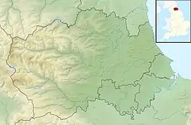
| Location | MAGiC MaP |
| Nearest town | Consett |
| Coordinates | 54°54′11″N 1°40′41″W / 54.90306°N 1.67806°W |
| Area | 6.8 ha (17 acres) |
| Established | 1987 |
| Governing body | Natural England |
| Website | Causey Bank Mires SSSI |
Causey Bank Mires is a Site of Special Scientific Interest in the Derwentside district of County Durham, England. It lies alongside and to the west of the Tanfield Railway, just under 1 km north of the Causey Arch.
The site consists of a series of flushes with scrub, surrounded by acid and neutral grassland, a habitat with a restricted distribution in County Durham. A number of locally rare plant species are found in the area, including globe-flower, Trollius europaeus. [1]
References
- ↑ "Causey Bank Mires : Reasons for SSSI status" (PDF). Natural England. Retrieved 1 April 2022.
This article is issued from Wikipedia. The text is licensed under Creative Commons - Attribution - Sharealike. Additional terms may apply for the media files.