Nangis | |
|---|---|
 | |
| Country | France |
| Region | Île-de-France |
| Department | Seine-et-Marne |
| No. of communes | 46 |
| Seat | Nangis |
| Area | 579.85 km2 (223.88 sq mi) |
| Population | 60,831 |
| • Density | 105/km2 (270/sq mi) |
| INSEE code | 77 14 |
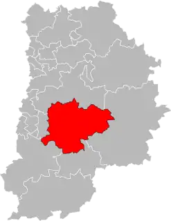
The canton of Nangis is a French administrative division, located in the Seine-et-Marne département (Île-de-France région).
Demographics
| Year | Pop. | ±% p.a. |
|---|---|---|
| 2013 | 57,952 | — |
| 2018 | 60,315 | +0.80% |
| Source: INSEE[2][3] | ||
Composition
At the French canton reorganisation which came into effect in March 2015, the canton was expanded from 17 to 46 communes:[4]
- Andrezel
- Argentières
- Aubepierre-Ozouer-le-Repos
- Beauvoir
- Blandy
- Bois-le-Roi
- Bombon
- Bréau
- Champdeuil
- Champeaux
- La Chapelle-Gauthier
- La Chapelle-Rablais
- Chartrettes
- Châteaubleau
- Le Châtelet-en-Brie
- Châtillon-la-Borde
- Clos-Fontaine
- Courtomer
- Crisenoy
- La Croix-en-Brie
- Échouboulains
- Les Écrennes
- Féricy
- Fontaine-le-Port
- Fontains
- Fontenailles
- Fouju
- Gastins
- Grandpuits-Bailly-Carrois
- Guignes
- Machault
- Moisenay
- Mormant
- Nangis
- Pamfou
- Quiers
- Rampillon
- Saint-Just-en-Brie
- Saint-Méry
- Saint-Ouen-en-Brie
- Sivry-Courtry
- Valence-en-Brie
- Vanvillé
- Verneuil-l'Étang
- Vieux-Champagne
- Yèbles
See also
References
- ↑ "Téléchargement du fichier d'ensemble des populations légales en 2021". The National Institute of Statistics and Economic Studies. 28 December 2023.
- ↑ Populations légales 2013: Téléchargement du fichier d'ensemble, INSEE
- ↑ Téléchargement du fichier d'ensemble des populations légales en 2018, INSEE
- ↑ Décret n° 2014-186 du 18 février 2014 portant délimitation des cantons dans le département de Seine-et-Marne
48°36′27″N 3°06′27″E / 48.60750°N 3.10750°E
This article is issued from Wikipedia. The text is licensed under Creative Commons - Attribution - Sharealike. Additional terms may apply for the media files.