| Broad Creek Tributary to Bogue Sound | |
|---|---|
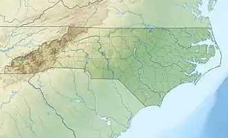
 Location of Broad Creek mouth | |
| Location | |
| Country | United States |
| State | North Carolina |
| County | Carteret |
| Physical characteristics | |
| Source | confluence of East and West Prongs of Broad Creek |
| • location | Broad Creek, North Carolina |
| • coordinates | 34°48′06″N 076°29′24″W / 34.80167°N 76.49000°W[1] |
| • elevation | 0 ft (0 m) |
| Mouth | Bogue Sound |
• location | Broad Creek, North Carolina[2] |
• coordinates | 34°47′57″N 076°29′12″W / 34.79917°N 76.48667°W[3] |
• elevation | 0 ft (0 m) |
| Length | 0.76 mi (1.22 km)[4] |
| Basin size | 6.28 square miles (16.3 km2) |
| Discharge | |
| • location | Bogue Sound |
| • average | 10.77 cu ft/s (0.305 m3/s) at mouth with Bogue Sound[5] |
| Basin features | |
| Progression | Broad → Bogue → Atlantic Ocean |
| River system | White Oak River |
| Tributaries | |
| • left | East Prong of Broad Creek |
| • right | West Prong of Broad Creek |
Broad Creek is a water body bordering the community of Broad Creek, North Carolina. The creek empties into Bogue Sound, which is separated from the Atlantic Ocean by Bogue Banks, part of North Carolina's barrier islands known as the Southern Outer Banks. The creek also runs through the Croatan National Forest.
See also
References
- ↑ "GNIS Detail - Broad Creek". geonames.usgs.gov. US Geological Survey. Retrieved 27 July 2019.
- ↑ "Broad Creek Topo Map, Carteret County NC (Salter Path Area)". TopoZone. Locality, LLC. Retrieved 27 July 2019.
- ↑ "GNIS Detail - Broad Creek". geonames.usgs.gov. US Geological Survey. Retrieved 27 July 2019.
- ↑ "Broad Creek Watershed Report". Waters Geoviewer. US EPA. Retrieved 27 July 2019.
- ↑ "Broad Creek Watershed Report". Waters Geoviewer. US EPA. Retrieved 27 July 2019.
U.S. Geological Survey Geographic Names Information System: Broad Creek (Bogue Sound)
This article is issued from Wikipedia. The text is licensed under Creative Commons - Attribution - Sharealike. Additional terms may apply for the media files.