| Brave Dog Mountain | |
|---|---|
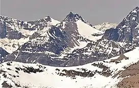 Brave Dog Mountain, northeast aspect | |
| Highest point | |
| Elevation | 8,500 ft (2,600 m)[1] NAVD 88 |
| Prominence | 780 ft (240 m)[1] |
| Coordinates | 48°21′32″N 113°27′40″W / 48.35889°N 113.46111°W[2][2] |
| Geography | |
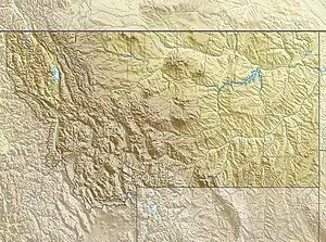 Brave Dog Mountain Location in Montana  Brave Dog Mountain Location in the United States | |
| Location | Flathead County, Montana, U.S. |
| Parent range | Lewis Range |
| Topo map | USGS Blacktail, MT |
Brave Dog Mountain (8,468 feet (2,581 m)) is located in the Lewis Range, Glacier National Park in the U.S. state of Montana.[3]
See also
References
- 1 2 "Brave Dog Mountain, Montana". Peakbagger.com. Retrieved June 4, 2018.
- 1 2 "Brave Dog Mountain". Geographic Names Information System. United States Geological Survey, United States Department of the Interior. Retrieved June 4, 2018.
- ↑ Blacktail, MT (Map). TopoQwest (United States Geological Survey Maps). Retrieved June 4, 2018.
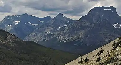
Brave Dog Mountain centered, from Firebrand Pass with Sheep Mountain to left, Peak 8888 to right
This article is issued from Wikipedia. The text is licensed under Creative Commons - Attribution - Sharealike. Additional terms may apply for the media files.