Bréhand
Brehant-Monkontour | |
|---|---|
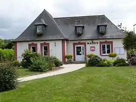 The town hall of Bréhand | |
 Flag  Coat of arms | |
Location of Bréhand | |
 Bréhand 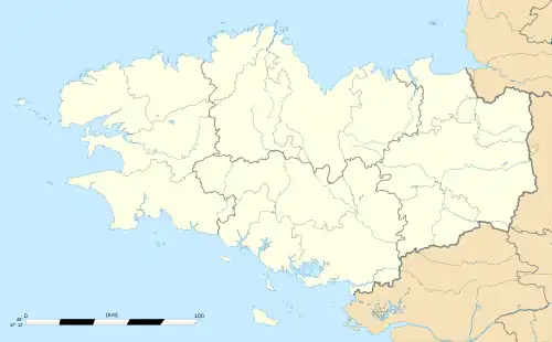 Bréhand | |
| Coordinates: 48°24′13″N 2°34′23″W / 48.4036°N 2.573°W | |
| Country | France |
| Region | Brittany |
| Department | Côtes-d'Armor |
| Arrondissement | Saint-Brieuc |
| Canton | Plénée-Jugon |
| Intercommunality | CA Lamballe Terre et Mer |
| Government | |
| • Mayor (2020–2026) | Yves Ruffet[1] |
| Area 1 | 24.95 km2 (9.63 sq mi) |
| Population | 1,707 |
| • Density | 68/km2 (180/sq mi) |
| Time zone | UTC+01:00 (CET) |
| • Summer (DST) | UTC+02:00 (CEST) |
| INSEE/Postal code | 22015 /22510 |
| Elevation | 58–150 m (190–492 ft) |
| 1 French Land Register data, which excludes lakes, ponds, glaciers > 1 km2 (0.386 sq mi or 247 acres) and river estuaries. | |
Bréhand (French pronunciation: [bʁeɑ̃]; Breton: Brehant-Monkontour; Gallo: Berhaund-Moncontór) is a commune in the Côtes-d'Armor department of Brittany in northwestern France.
Population
| Year | Pop. | ±% |
|---|---|---|
| 1962 | 1,290 | — |
| 1968 | 1,307 | +1.3% |
| 1975 | 1,247 | −4.6% |
| 1982 | 1,369 | +9.8% |
| 1990 | 1,287 | −6.0% |
| 1999 | 1,271 | −1.2% |
| 2008 | 1,421 | +11.8% |
Inhabitants of Bréhand are called Bréhandais in French.
See also
References
- ↑ "Répertoire national des élus: les maires". data.gouv.fr, Plateforme ouverte des données publiques françaises (in French). 2 December 2020.
- ↑ "Populations légales 2021". The National Institute of Statistics and Economic Studies. 28 December 2023.
Wikimedia Commons has media related to Bréhand.
This article is issued from Wikipedia. The text is licensed under Creative Commons - Attribution - Sharealike. Additional terms may apply for the media files.