| Blackbutt Shellharbour, New South Wales | |||||||||||||||
|---|---|---|---|---|---|---|---|---|---|---|---|---|---|---|---|
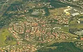
 Aerial view from the east. | |||||||||||||||
 Blackbutt | |||||||||||||||
| Coordinates | 34°34.3′S 150°50.3′E / 34.5717°S 150.8383°E | ||||||||||||||
| Population | 3,301 (2016 census)[1] | ||||||||||||||
| Postcode(s) | 2529 | ||||||||||||||
| LGA(s) | City of Shellharbour | ||||||||||||||
| Region | Illawarra | ||||||||||||||
| County | Camden | ||||||||||||||
| Parish | Terragong | ||||||||||||||
| State electorate(s) | Shellharbour | ||||||||||||||
| Federal division(s) | Whitlam | ||||||||||||||
| |||||||||||||||
Blackbutt is a southern suburb of Shellharbour, New South Wales, Australia. The eastern half of the suburb is occupied by the Blackbutt Forest Reserve. The suburb was named after the blackbutt tree, Eucalyptus pilularis.[2]
References
- ↑ Australian Bureau of Statistics (27 June 2017). "Blackbutt (State Suburb)". 2016 Census QuickStats. Retrieved 14 July 2017.
- ↑ Colfelt, Emma (9 December 2017). "Blackbutt | Shellharbour Local History". museum.shellharbour.nsw.gov.au. Retrieved 3 February 2023.
This article is issued from Wikipedia. The text is licensed under Creative Commons - Attribution - Sharealike. Additional terms may apply for the media files.