Bioko Sur | |
|---|---|
 | |
| Country | Equatorial Guinea |
| Capital | Luba |
| Area | |
| • Total | 1,241 km2 (479 sq mi) |
| Population (2015)[1] | |
| • Total | 34,674 |
| • Density | 28/km2 (72/sq mi) |

A clickable map of Equatorial Guinea exhibiting its two regions and eight provinces. The island nation of São Tomé and Príncipe is not part of Equatorial Guinea.
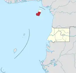
Bioko Sur (Spanish pronunciation: [ˈbjo.ko suɾ] Spanish for "South Bioko") is a province of Equatorial Guinea. Its capital is Luba. It occupies the southern part of the island of Bioko, the remainder of which is part of Bioko Norte.
Part of the Parque Nacional del Pico Basilé, created in 2000, is in Bioko Sur.
References
- ↑ "Censo de población 2015–República de Guinea Ecuatorial" (PDF) (in Spanish). INEGE. p. 7. Archived from the original (PDF) on 8 October 2017. Retrieved 8 October 2017.
3°26′24″N 8°38′24″E / 3.44000°N 8.64000°E
This article is issued from Wikipedia. The text is licensed under Creative Commons - Attribution - Sharealike. Additional terms may apply for the media files.