Balta
Балта | |
|---|---|
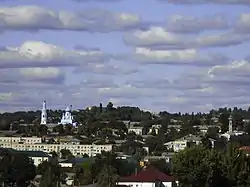 The city view | |
.png.webp) Flag  Coat of arms | |
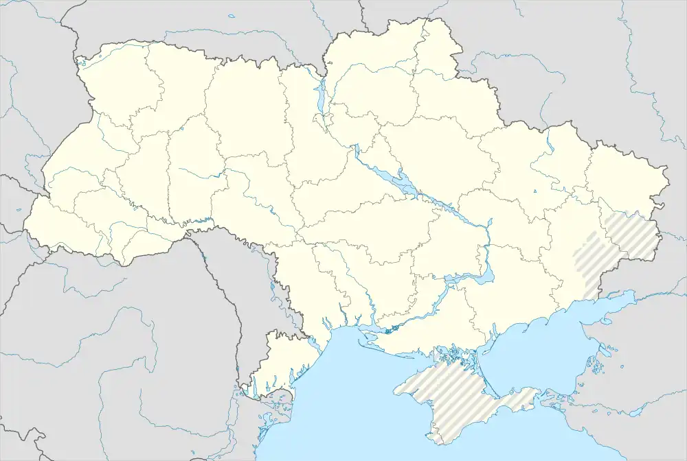 Balta Location of Balta in Odesa Oblast 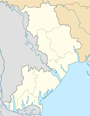 Balta Balta (Odesa Oblast) | |
| Coordinates: 47°56′24″N 29°37′19″E / 47.94000°N 29.62194°E | |
| Country | |
| Oblast | |
| Raion | |
| Hromada | Balta urban hromada |
| Founded | 1526 |
| Government | |
| • Mayor | Serhiy Mazur[1] |
| Area | |
| • Total | 22.97 km2 (8.87 sq mi) |
| Elevation | 23 m (75 ft) |
| Population (2022) | |
| • Total | |
| Time zone | UTC+2 (EET) |
| • Summer (DST) | UTC+3 (EEST) |
| Postal code | 66100—66105 |
| Area code | +380 4866 |
| Website | |
Balta (Ukrainian: Ба́лта, pronounced [ˈbɑɫtɐ] ⓘ) is a city in Podilsk Raion, Odesa Oblast in south-western Ukraine. It hosts the administration of Balta urban hromada, one of the hromadas of Ukraine.[3] Population: 17,854 (2022 estimate).[4] The city's population was 19,772 as of the 2001 Ukrainian Census.[5]
Name
In addition to the Ukrainian: Балта (Balta), in other languages the name of the city is Romanian: Balta and Yiddish: באַלטאַ.
History

Balta is located near the Dniester River border with Moldova.
First mentions of Balta go all the way to 1526. Until 1792 Balta was part of the Ottoman Empire.[6] In 1797 two nearby towns; Yuzefhrad (Юзефград, Polish: Józefgród, until 1793 part of Poland) and Yelensk (Еленськ), were added to the city. It is located in the historic Podolia region of Ukraine.[7] According to the Russian census of 1897, with a population of 23,363 it was the fourth largest city of Podolia after Kamianets-Podilskyi, Uman and Vinnytsia. In 1900, the city's Jewish population numbered 13,235.[7]
Pogroms occurred in Balta in 1882 and 1905.[8]
From 1924–1929, the city was the capital of the Moldavian Autonomous Soviet Socialist Republic.[6] With the annexation of Bessarabia in 1940, Balta became a part of the Odesa Oblast of the Ukrainian Soviet Socialist Republic.[6] It was occupied by German and Romanian troops on 5 August 1941 and became part of Transnistria Governorate in Kingdom of Romania until its liberation on 29 March 1944 by Red Army.
Until 2016, Balta was part of Balta Raion. On 4 February 2016, it was designated the city of oblast significance but remained the administrative center of the raion.[9] It was incorporated as the center of Balta Municipality. The municipality was abolished in July 2020 as part of the administrative reform of Ukraine, which reduced the number of raions of Odesa Oblast to seven. The area of Balta Municipality was merged into Podilsk Raion.[10][11]
Population
| 1849 | 1860 | 1897 | 1959 | 1970 | 1979 | 1989 | 2001 | 2016 |
|---|---|---|---|---|---|---|---|---|
| 9810 | 14 154 | 23 363 | 17 922 | 20 317 | 20 929 | 23 293 | 19 962 | 18 955 |
Language
Distribution of the population by native language according to the 2001 census:[12]
| Language | Percentage |
|---|---|
| Ukrainian | 81.02% |
| Russian | 17.41% |
| other/undecided | 1.57% |
Notable people
- Aryeh Altman, Israeli politician
- Yuly Aykhenvald, Ukrainian Jewish literary critic
- Zellig Harris, American linguist, mathematical syntactician, and methodologist of science
- Vsevolod Holubovych, Prime Minister of the Ukrainian People's Republic
- Grigori Panteleimonov, Russian sport shooter who competed in the 1912 Summer Olympics
- Aryeh Leib Schochet, Rabbi
- Samuel (Sholem) Schwarzbard, (1886–1938), Yiddish poet, watchmaker, soldier, anarchist; grew up in Balta
- Louis E. Stern (b. 08/27/1886 d. 01/11/1962), American International Lawyer, patron and friend of Chagall, Picasso, Klee and Miro, collection left to Philadelphia Museum of Art and Brooklyn Museum
- Judah Even Shemuel
- Iosif Shkolnik, was a painter and set designer
- Alexander Veprik, composer and music educator
References
- ↑ "Biographical reference". Balta City Council (in Ukrainian). Archived from the original on 2013-04-19. Retrieved 15 March 2013.
- ↑ "Balta (Odesa Oblast, Balta Raion)". weather.in.ua. Retrieved 15 March 2013.
- ↑ "Балтская громада" (in Russian). Портал об'єднаних громад України.
- ↑ Чисельність наявного населення України на 1 січня 2022 [Number of Present Population of Ukraine, as of January 1, 2022] (PDF) (in Ukrainian and English). Kyiv: State Statistics Service of Ukraine. Archived (PDF) from the original on 4 July 2022.
- ↑ "Balta, Odesa Oblast, Balta Raion". Regions of Ukraine and their Structure (in Ukrainian). Verkhovna Rada of Ukraine. Archived from the original on 7 March 2016. Retrieved 15 March 2013.
- 1 2 3 "Historical reference". Balta City Council (in Ukrainian). Archived from the original on 2013-04-19. Retrieved 15 March 2013.
- 1 2 "Balta, Ukraine". JewishGen Locality Page. JewishGen. Retrieved 15 March 2013.
- ↑ Encyclopedia Judaica, "Balta, Ukraine." Retrieved 10/1/2018.
- ↑ "Законодатели согласились на все предложения". Thesis (in Russian). 4 February 2016.
- ↑ "Про утворення та ліквідацію районів. Постанова Верховної Ради України № 807-ІХ". Голос України (in Ukrainian). 2020-07-18. Retrieved 2020-10-03.
- ↑ "Нові райони: карти + склад" (in Ukrainian). Міністерство розвитку громад та територій України. July 17, 2020.
- ↑ https://socialdata.org.ua/projects/mova-2001/
External links
 Media related to Category:Balta,_Ukraine at Wikimedia Commons
- "Main". Balta City Council (in Ukrainian). Archived from the original on 25 December 2012. Retrieved 15 March 2013.