Bütow | |
|---|---|
Location of Bütow within Mecklenburgische Seenplatte district 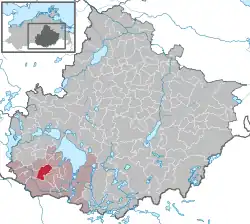 | |
 Bütow 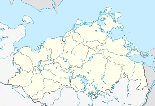 Bütow | |
| Coordinates: 53°21′N 12°29′E / 53.350°N 12.483°E | |
| Country | Germany |
| State | Mecklenburg-Vorpommern |
| District | Mecklenburgische Seenplatte |
| Municipal assoc. | Röbel-Müritz |
| Government | |
| • Mayor | Siegfried Haustein |
| Area | |
| • Total | 26.32 km2 (10.16 sq mi) |
| Elevation | 78 m (256 ft) |
| Population (2021-12-31)[1] | |
| • Total | 461 |
| • Density | 18/km2 (45/sq mi) |
| Time zone | UTC+01:00 (CET) |
| • Summer (DST) | UTC+02:00 (CEST) |
| Postal codes | 17209 |
| Dialling codes | 039922 |
| Vehicle registration | MÜR |
| Website | www |
Bütow is a municipality in the Mecklenburgische Seenplatte district, in Mecklenburg-Vorpommern, Germany.
Geography
Bütow is located in the Mecklenburg Lake Plateau, to the east of the source of the Elde river. It is a hilly area, with the highest point 101 m (331 ft) above sea level.
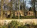
- Church ruin in Bütow-Dambeck
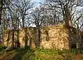 Nave
Nave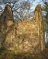 Choir
Choir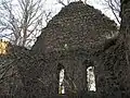 Gable
Gable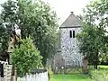 Village church in Bütow.
Transportation
Bütow is located about two kilometers away from the federal highway B 198. The Autobahn 19 Berlin - Rostock is about three kilometers away. The nearest railway station is located in Malchow.
References
- ↑ "Bevölkerungsstand der Kreise, Ämter und Gemeinden 2021" (XLS) (in German). Statistisches Amt Mecklenburg-Vorpommern. 2022.
External links
![]() Media related to Bütow at Wikimedia Commons
Media related to Bütow at Wikimedia Commons
This article is issued from Wikipedia. The text is licensed under Creative Commons - Attribution - Sharealike. Additional terms may apply for the media files.