Aumes | |
|---|---|
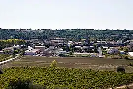 A general view of Aumes | |
.svg.png.webp) Coat of arms | |
Location of Aumes | |
 Aumes 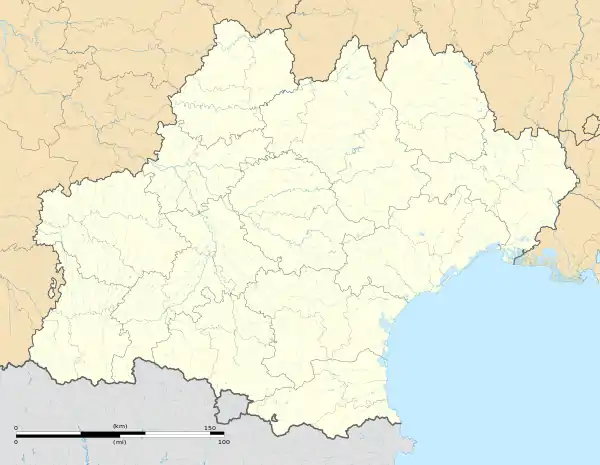 Aumes | |
| Coordinates: 43°28′01″N 3°27′49″E / 43.4669°N 3.4636°E | |
| Country | France |
| Region | Occitania |
| Department | Hérault |
| Arrondissement | Béziers |
| Canton | Mèze |
| Intercommunality | CA Hérault Méditerranée |
| Government | |
| • Mayor (2022–2026) | Jacques Moncouyoux[1] |
| Area 1 | 7.39 km2 (2.85 sq mi) |
| Population | 501 |
| • Density | 68/km2 (180/sq mi) |
| Time zone | UTC+01:00 (CET) |
| • Summer (DST) | UTC+02:00 (CEST) |
| INSEE/Postal code | 34017 /34530 |
| Elevation | 6–106 m (20–348 ft) (avg. 80 m or 260 ft) |
| 1 French Land Register data, which excludes lakes, ponds, glaciers > 1 km2 (0.386 sq mi or 247 acres) and river estuaries. | |
Aumes (French pronunciation: [om]; Occitan: Aumas) is a commune in the Hérault department in southern France. Guillaume d’Abbes de Cabrebolles (1718–1802), Encyclopédiste, died in Aumes.
Population
| Year | Pop. | ±% p.a. |
|---|---|---|
| 1968 | 310 | — |
| 1975 | 305 | −0.23% |
| 1982 | 286 | −0.91% |
| 1990 | 268 | −0.81% |
| 1999 | 310 | +1.63% |
| 2007 | 410 | +3.56% |
| 2012 | 453 | +2.01% |
| 2017 | 483 | +1.29% |
| Source: INSEE[3] | ||
Images
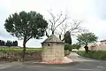 Well
Well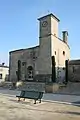 Church St-Pierre
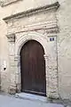 Door of the presbytery.
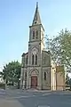 Church of St. Aubin
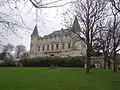 Castle Saint Martin de Graves.
See also
References
- ↑ "Répertoire national des élus: les maires" (in French). data.gouv.fr, Plateforme ouverte des données publiques françaises. 6 June 2023.
- ↑ "Populations légales 2021". The National Institute of Statistics and Economic Studies. 28 December 2023.
- ↑ Population en historique depuis 1968, INSEE
Wikimedia Commons has media related to Aumes.
This article is issued from Wikipedia. The text is licensed under Creative Commons - Attribution - Sharealike. Additional terms may apply for the media files.