| Amur Oblast, Russia | |
|---|---|
| Administrative center: Blagoveshchensk | |
| As of 2015:[1] | |
| # of districts (районы) | 20 |
| # of cities/towns (города) | 10 |
| # of urban-type settlements (посёлки городского типа) | 18 |
| # of selsovets (сельсоветы) | 250 |
| As of 2002:[2] | |
| # of rural localities (сельские населённые пункты) | 608 |
| # of uninhabited rural localities (сельские населённые пункты без населения) | 6 |

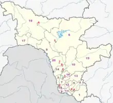
Map of the administrative divisions of Amur Oblast
Administrative and municipal divisions
- ※ - under the oblast's jurisdiction
| Division | Structure | OKATO | OKTMO | Urban-type settlement/ district-level town* |
Rural (selsovet) | ||
|---|---|---|---|---|---|---|---|
| Administrative | Municipal | ||||||
| Tsiolkovsky (Циолковский) | city (ZATO) | urban okrug | 10 545 | 10 770 | |||
| Blagoveshchensk (Благовещенск) | city | urban okrug | 10 401 | 10 701 | |||
| Belogorsk (Белогорск) | city | urban okrug | 10 410 | 10 710 |
|
||
| Zeya (Зея) | city | urban okrug | 10 412 | 10 712 | |||
| Raychikhinsk (Райчихинск) | city | urban okrug | 10 420 | 10 720 | |||
| Svobodny (Свободный) | city | urban okrug | 10 430 | 10 730 | |||
| Tynda (Тында) | city | urban okrug | 10 432 | 10 732 | |||
| Shimanovsk (Шимановск) | city | urban okrug | 10 440 | 10 740 | |||
| Progress (Прогресс) | urban-type settlement※ | urban okrug | 10 465 | 10 775 | |||
| Arkharinsky (Архаринский) | district | 10 205 | 10 605 |
|
15 | ||
| Belogorsky (Белогорский) | district | 10 208 | 10 608 | 13 | |||
| Blagoveshchensky (Благовещенский) | district | 10 211 | 10 611 | 11 | |||
| Bureysky (Бурейский) | district | 10 215 | 10 615 |
|
8 | ||
| Zavitinsky (Завитинский) | district | 10 221 | 10 621 |
|
9 | ||
| Zeysky (Зейский) | district | 10 225 | 10 625 | 21 | |||
| Ivanovsky (Ивановский) | district | 10 228 | 10 628 | 15 | |||
| Konstantinovsky (Константиновский) | district | 10 230 | 10 630 | 14 | |||
| Magdagachinsky (Магдагачинский) | district | 10 231 | 10 631 |
|
8 | ||
| Mazanovsky (Мазановский) | district | 10 232 | 10 632 | 15 | |||
| Mikhaylovsky (Михайловский) | district | 10 235 | 10 635 | 11 | |||
| Oktyabrsky (Октябрьский) | district | 10 238 | 10 638 | 15 | |||
| Romnensky (Ромненский) | district | 10 240 | 10 640 | 10 | |||
| Svobodnensky (Свободненский) | district | 10 242 | 10 642 | 15 | |||
| Selemdzhinsky (Селемджинский) | district | 10 245 | 10 645 | 4 | |||
| Seryshevsky (Серышевский) | district | 10 247 | 10 647 |
|
15 | ||
| Skovorodinsky (Сковородинский) | district | 10 249 | 10 649 |
|
6 | ||
| Tambovsky (Тамбовский) | district | 10 251 | 10 651 | 13 | |||
| Tyndinsky (Тындинский) | district | 10 254 | 10 654 | 20 | |||
| Shimanovsky (Шимановский) | district | 10 255 | 10 655 | 13 | |||
References
- ↑ Государственный комитет Российской Федерации по статистике. Комитет Российской Федерации по стандартизации, метрологии и сертификации. №ОК 019-95 1 января 1997 г. «Общероссийский классификатор объектов административно-территориального деления. Код 10», в ред. изменения №278/2015 от 1 января 2016 г.. (State Statistics Committee of the Russian Federation. Committee of the Russian Federation on Standardization, Metrology, and Certification. #OK 019-95 January 1, 1997 Russian Classification of Objects of Administrative Division (OKATO). Code 10, as amended by the Amendment #278/2015 of January 1, 2016. ).
- ↑ Results of the 2002 Russian Population Census—Territory, number of districts, inhabited localities, and rural administrations of the Russian Federation by federal subject Archived September 28, 2011, at the Wayback Machine
This article is issued from Wikipedia. The text is licensed under Creative Commons - Attribution - Sharealike. Additional terms may apply for the media files.