Abbey Town | |
|---|---|
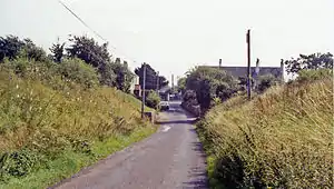
 Location of the former station (1991) | |
| General information | |
| Location | Abbey Town, Allerdale England |
| Coordinates | 54°50′45″N 3°17′16″W / 54.8459°N 3.2877°W |
| Grid reference | NY174508 |
| Platforms | 1 |
| Other information | |
| Status | Disused |
| History | |
| Original company | Carlisle and Silloth Bay Railway |
| Pre-grouping | North British Railway |
| Post-grouping | London and North Eastern Railway |
| Key dates | |
| 22 August 1856 | Station opened as Abbey |
| August 1889 | Renamed Abbey Town |
| 7 September 1964 | Station closed |
Carlisle and Silloth Bay Railway | ||||||||||||||
|---|---|---|---|---|---|---|---|---|---|---|---|---|---|---|
| ||||||||||||||
Abbey Town railway station was on the branch line off the Solway Junction Railway in the English county of Cumberland (later Cumbria). The first station after Abbey Junction on the branch to Silloth on the Solway Firth, it served the village of Abbey Town. The station closed with the line to Silloth in 1964.
History
Opened as Abbey by the Carlisle and Silloth Bay Railway in 1856, then renamed Abbey Town by the North British Railway in 1889, it became part of the London and North Eastern Railway during the Grouping of 1923. The station then passed on to the London Midland Region of British Railways on nationalisation in 1948. The station closed on 7 September 1964.
References
- Butt, R. V. J. (October 1995). The Directory of Railway Stations: details every public and private passenger station, halt, platform and stopping place, past and present (1st ed.). Sparkford: Patrick Stephens Ltd. ISBN 978-1-85260-508-7. OCLC 60251199. OL 11956311M.
- Jowett, Alan (2000). Jowett's Nationalised Railway Atlas (1st ed.). Penryn, Cornwall: Atlantic Transport Publishers. ISBN 978-0-906899-99-1. OCLC 228266687.
Further material
- Oatway, Jim (2003) [1964]. Cumberland Glory (DVD). Ultimate Archive Steam. Uffington, Shropshire: B&R Video Productions. Vol 44.
External links
- Pictures of the station, via Cumbrian Railways Association
- Carlisle & Silloth Bay Railway, via Cumbrian Railways Association
- The area's railways, via Holme St Cuthbert History Group
- Abbey Town station on navigable 1956 O. S. map, via npe Maps
- The station on an Edwardian OS map, via National Library of Scotland
- The station via Rail Map Online
| Preceding station | Disused railways | Following station | ||
|---|---|---|---|---|
| Sleightholme Line and station closed |
North British Railway Carlisle and Silloth Bay Railway |
Black Dyke Halt Line and station closed |
This article is issued from Wikipedia. The text is licensed under Creative Commons - Attribution - Sharealike. Additional terms may apply for the media files.