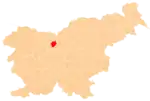
Šenturška Gora | |
|---|---|
 | |
 Šenturška Gora Location in Slovenia | |
| Coordinates: 46°15′30.27″N 14°32′42.83″E / 46.2584083°N 14.5452306°E | |
| Country | |
| Traditional Region | Upper Carniola |
| Statistical region | Upper Carniola |
| Municipality | Cerklje na Gorenjskem |
| Area | |
| • Land | 2.6 km2 (1.0 sq mi) |
| Elevation | 666.7 m (2,187.3 ft) |
| Population (2020) | |
| • Total | 183 |
| [1] | |
Šenturška Gora (pronounced [ʃɛnˈtuːɾʃka ˈɡɔːɾa] or [ʃənˈtuːɾʃka ˈɡɔːɾa]; German: Ulrichsberg[2]) is a small settlement in the Municipality of Cerklje na Gorenjskem in the Upper Carniola region of Slovenia.
The local church is dedicated to Saint Ulrich, thus the name of the village (literally, 'Mount Saint Ulrich'). It was built in 1368 and extended in the late 17th century.[3]
References
- ↑ Statistical Office of the Republic of Slovenia
- ↑ Leksikon občin kraljestev in dežel zastopanih v državnem zboru, vol. 6: Kranjsko. 1906. Vienna: C. Kr. Dvorna in Državna Tiskarna, p. 52.
- ↑ Cerklje municipal site
External links
 Media related to Šenturška Gora at Wikimedia Commons
- Šenturška Gora on Geopedia
This article is issued from Wikipedia. The text is licensed under Creative Commons - Attribution - Sharealike. Additional terms may apply for the media files.
