Épaignes | |
|---|---|
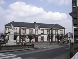 Town hall | |
.svg.png.webp) Coat of arms | |
Location of Épaignes | |
 Épaignes  Épaignes | |
| Coordinates: 49°16′49″N 0°26′28″E / 49.2803°N 0.4411°E | |
| Country | France |
| Region | Normandy |
| Department | Eure |
| Arrondissement | Bernay |
| Canton | Beuzeville |
| Intercommunality | Lieuvin Pays d'Auge |
| Government | |
| • Mayor (2020–2026) | Marie-Paule Leblanc[1] |
| Area 1 | 26.1 km2 (10.1 sq mi) |
| Population | 1,558 |
| • Density | 60/km2 (150/sq mi) |
| Time zone | UTC+01:00 (CET) |
| • Summer (DST) | UTC+02:00 (CEST) |
| INSEE/Postal code | 27218 /27260 |
| Elevation | 84–181 m (276–594 ft) (avg. 164 m or 538 ft) |
| 1 French Land Register data, which excludes lakes, ponds, glaciers > 1 km2 (0.386 sq mi or 247 acres) and river estuaries. | |
Épaignes (French pronunciation: [epɛɲ]) is a commune in the Eure department in northern France.
Population
| Year | Pop. | ±% p.a. |
|---|---|---|
| 1968 | 947 | — |
| 1975 | 964 | +0.25% |
| 1982 | 1,029 | +0.94% |
| 1990 | 1,090 | +0.72% |
| 1999 | 1,158 | +0.67% |
| 2009 | 1,332 | +1.41% |
| 2014 | 1,529 | +2.80% |
| 2020 | 1,561 | +0.35% |
| Source: INSEE[3] | ||
See also
References
- ↑ "Répertoire national des élus: les maires" (in French). data.gouv.fr, Plateforme ouverte des données publiques françaises. 13 September 2022.
- ↑ "Populations légales 2021". The National Institute of Statistics and Economic Studies. 28 December 2023.
- ↑ Population en historique depuis 1968, INSEE
Wikimedia Commons has media related to Épaignes.
This article is issued from Wikipedia. The text is licensed under Creative Commons - Attribution - Sharealike. Additional terms may apply for the media files.