< Page:Provincial geographies of India (Volume 1).djvu
This page has been proofread, but needs to be validated.
ch. ii]
MOUNTAINS, HILLS, AND PLAINS
9
Indian Ocean. The Tsanpo has a still longer course of 800 miles eastwards before it too bends southwards to flow through Assam into the Bay of Bengal. Between the points where these two giant rivers change their direction there extends for a distance of 1500 miles the
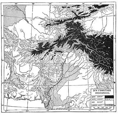
Fig. 2. Orographical Map.
vast congeries of mountain ranges known collectively as the "Himalaya" or "Abode of Snow." As a matter of convenience the name is sometimes confined to the mountains east of the Indus, but geologically the hills of Buner and Swat to the north of Peshawar probably belong to the same system. In Sanskrit literature the
This article is issued from Wikisource. The text is licensed under Creative Commons - Attribution - Sharealike. Additional terms may apply for the media files.