< Africa by Élisée Reclus < Volume 2


APPENDIX.
STATISTICAL TABLES.
TRIPOLITANA.
| Area, including the Kufra Oasis | 485,000 | sq. miles |
| Population, according to Behm and Wagner | 1,010,000 | |
| Area of Barka, excluding the Southern oases | 20,000 | sq. miles |
| Approximate population, according to Camperio | 246,000 |
AUJILA OASES.
| Area. | Population. | Date-palms. | ||||
| Aujila | 8 | sq. miles | (?) | 4,000 | 40,000 | |
| Jalo | 80 | " | (?) | 6,000 | 100,000 | |
| Wadi | 80 | " | (?) | 1,080 | 40,000 | (?) |
| Leshkerreh | 4 | " | (?) | 500 | 20,000 | (?) |
KUFRA OASES.
| Area according to Bohm. | ||
| Taiserbo | 2,536 | sq. miles |
| Sirhen | 820 | " |
| Buseima | 125 | " |
| Erbehna | 126 | " |
| Kebabo | 3,500 | " |
| Total | 7,105 | " |
Palm Groves of Tripolitana.
| Meshiya of Tripoli, | according | to Barth | 1,000,000 | palms | |
| Plantations | of Zawya | " | " | 130,000 | " |
| " | of Zenzur | " | to Rohlfe | 100,000 | " |
| " | of Tajura | " | " | 200,000 | " |
| Oasis of Zella | " | " | 100,000 | " | |
| " | of Jofra | " | " | 15,000 | " |
| Misda and Gharia | " | " | 1,000 | " | |
| Other plantations | 100,000(?) | " | |||
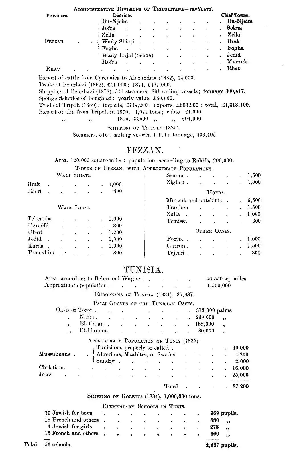
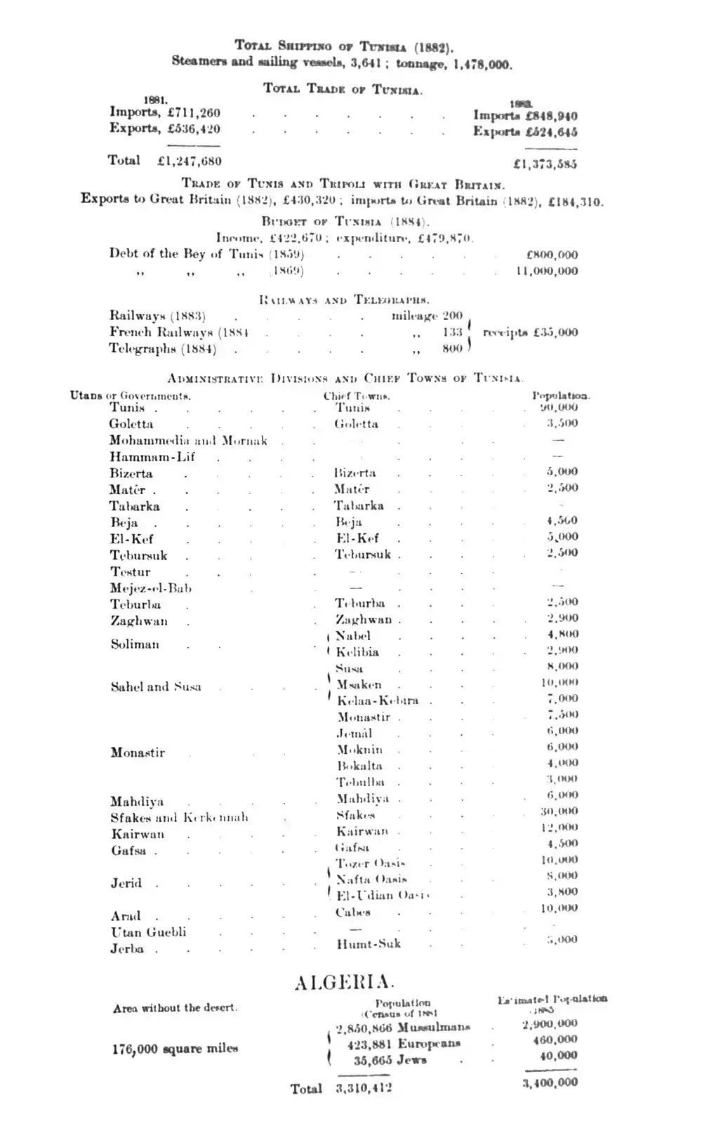
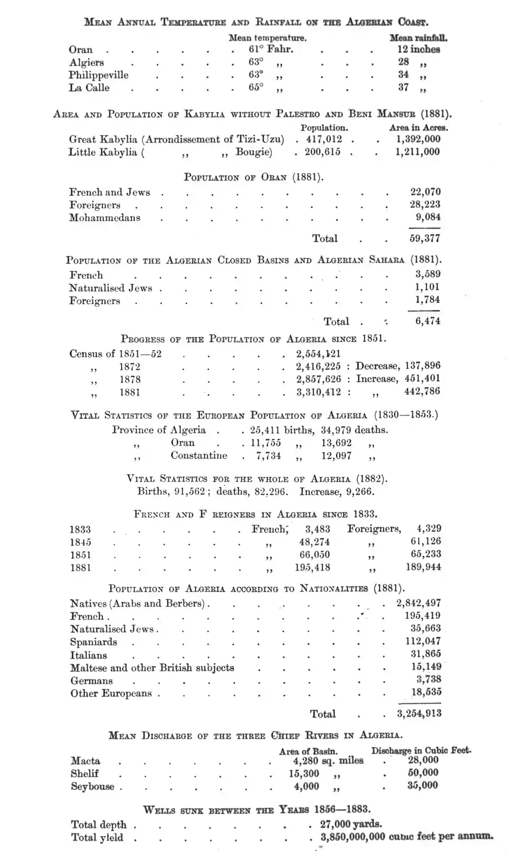
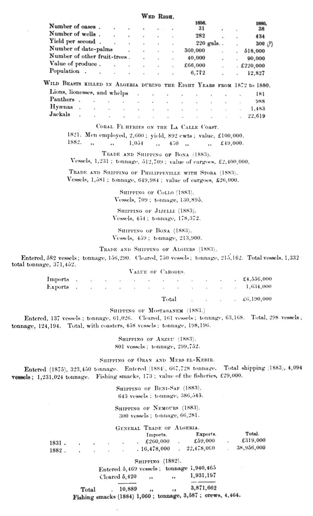
Administrative Divisions of Tripolitana.
| Provinces. | Districts. | Chief Towns. | |
| Barka | Jebel-el-Akabah | Derna | |
| Jebel-el-Akhdar | Benghazi | ||
| Aujila Oasis | Aujila | ||
| Jalo Oasis | Lebba | ||
| Leshkerreh Oasis | |||
| Tripoli | Tripoli | Tripoli | |
| Zawya | Zawya | ||
| Khoms | Lebda | ||
| Jebel | Kazr-el-Jebel | ||
| Ghadames | Ghadames |

This article is issued from Wikisource. The text is licensed under Creative Commons - Attribution - Sharealike. Additional terms may apply for the media files.