Yarra River
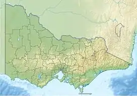
The Yarra River is also known as the Yarra Yarra River, Aboriginal: Berrern, Birr-arrung, Bay-ray-rung, Birarang.[4] Birrarung,[5] and Wongete). The Yarra River is a perennial river in east-central Victoria, Australia. The river flows from its source in the Yarra Ranges 242 kilometres (150 mi) west through the Yarra Valley. The river opens out into plains as it winds its way through Greater Melbourne. It then empties into Hobsons Bay in northernmost Port Phillip.
| Yarra Berrern Birr-arrung Wongete[1] Yarro-yarro | |
|---|---|
 The Yarra River through Pound Bend near Warrandyte. | |
| Etymology | Bunwurrung (Indigenous Australian): Yarro-yarro, "ever-flowing"[1] |
| Nickname(s) | The Yarra |
| Location | |
| Country | Australia |
| State | Victoria |
| Region | South Eastern Highlands (IBRA), Central Victoria |
| LGA | City of Hobsons Bay City of Port Phillip City of Melbourne City of Yarra City of Darebin City of Boroondara City of Banyule City of Manningham Shire of Nillumbik Yarra Ranges Shire |
| City | Melbourne |
| Physical characteristics | |
| Source | Yarra Ranges, Great Dividing Range |
| - location | within Yarra Ranges National Park |
| - coordinates | 37°44′57″S 146°8′26″E |
| - elevation | 792 m (2,598 ft) |
| Mouth | Hobsons Bay, Port Phillip |
| - location | near the suburb of Port Melbourne |
| - coordinates | 37°51′7″S 144°54′30″E |
| - elevation | 0 m (0 ft) |
| Length | 242 km (150 mi) |
| Basin size | 4,078 km2 (1,575 sq mi)50% |
| Discharge | |
| - location | mouth |
| - average | 37 m3/s (1,300 cu ft/s) |
| Basin features | |
| River system | Port Phillip and Western Port catchment |
| Tributaries | |
| - left | Maribyrnong River, Moonee Ponds Creek, Merri Creek, Darebin Creek, Plenty River, Diamond Creek, Steeles Creek, Watts River, Badger Creek, Don River, Cement Creek, O'Shannassy River |
| - right | Gardiners Creek, Glass Creek, Koonung Creek, Mullum Mullum Creek, Jumping Creek, Olinda Creek, Woori Yallock Creek, Hoddles Creek, Little Yarra River, Starvation Creek |
| National park | Yarra Ranges NP, Royal Botanic Gardens |
| [2][3] | |
The river was a major food source for indigenous Australians during prehistoric times. It also served as a meeting place during those times. The river was first called Birrarung by the Wurundjeri. The current name was translated wrong from another Wurundjeri term in the Boonwurrung language; Yarro-yarro, meaning "ever-flowing".
The river was used for agriculture by early European settlers. The landscape of the river has changed since 1835. The course of the river has been changed and widened in places. Widening and dams, like the Upper Yarra Reservoir have helped protect Melbourne from major flooding. Industrialisation led to the destruction of the marshlands at the joining of the Yarra and Maribyrnong Rivers in the area around Coode Island in West Melbourne. The yearly Moomba festival celebrates the Yarra River's meaning to Melbourne.
References
- "Yarra River: 30146: Historical Information". Vicnames. Government of Victoria. 2 May 1966. Archived from the original on 8 March 2014. Retrieved 8 March 2014.
- "Yarra River: 30146". Vicnames. Government of Victoria. 2 May 1966. Archived from the original on 8 March 2014. Retrieved 8 March 2014.
- "Map of Yarra River, VIC". Bonzle Digital Atlas of Australia. Retrieved 8 March 2014.
- "BYGONE DAYS". The Argus (Melbourne, Vic. : 1848 - 1956). Melbourne, Vic.: National Library of Australia. 15 July 1939. p. 13. Retrieved 5 November 2014.
- Eidelson, Meyer (1997). The Melbourne Dreaming. A Guide to the Aboriginal Places of Melbourne (Reprint 2000 ed.). Canberra: Aboriginal Studies Press. pp. 14–17. ISBN 0-85575-306-4.