Strait of Dover
The Strait of Dover or Dover Strait[1] is the strait at the narrowest part of the English Channel.

Map showing the location of the Strait of Dover.
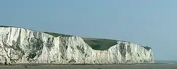
Cliffs at Dover
The strait is at the east end of the English Channel, where it joins the North Sea. Its width is the shortest distance between France and England. On a clear day, it is possible to see the coastline on the other side and the buildings on the shore without the help of binoculars.
The shortest distance across the strait is from the South Foreland, some 6 km (4 mi) north-east of Dover in the county of Kent, England, to Cap Gris Nez, a cape near Calais in the département of Pas-de-Calais, France. Between these two points – the most popular route for cross-channel swimmers – the distance is just 33 km (20 mi).
Notes
Other websites
- Channel Navigation Information Service Archived 2007-12-11 at the Wayback Machine
- Channel Swimming & Piloting Federation Archived 2011-04-30 at the Wayback Machine
- Channel Swimming Association
- Depth Chart showing straits and former course of Rhine Archived 2012-12-08 at Archive.today
This article is issued from Wikipedia. The text is licensed under Creative Commons - Attribution - Sharealike. Additional terms may apply for the media files.