Sofala Province
Sofala | |
|---|---|
.jpg.webp) Gogogo, the highest peak of the Gorongosa mountain complex | |
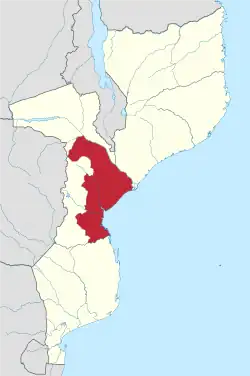 Sofala, Province of Mozambique | |
| Country | Mozambique |
| Capital | Beira |
| Area | |
| • Total | 68,018 km2 (26,262 sq mi) |
| Population (2017 census) | |
| • Total | 2,259,248 |
| • Density | 33/km2 (86/sq mi) |
| Postal code | 21xx |
| Area code | (+258) 23 |
| Website | www |
Sofala is a province of Mozambique. Beira is the capital of the province.
Rivers flowing through the province include the Chiveve River, the Buzi River, the Save River. Gorongosa National Park, at the southern end of the Great African Rift Valley, covers several thousand square kilometres. The park has the 1,863 metres (6,112 ft) Mount Gorongosa, a mountain which is considered sacred to the people of the country.[1]
Districts
Sofala Province is divided into the 12 districts of:
- Buzi District
- Caia District
- Chemba District
- Cheringoma District
- Chibabava District
- Dondo District
- Gorongosa District
- Marromeu District
- Machanga District
- Maringué District
- Muanza District
- Nhamatanda District
References
- Wilson, Edward O. (22 April 2014). A Window on Eternity: A Biologist's Walk Through Gorongosa National Park. Simon and Schuster. p. 2. ISBN 978-1-4767-4741-5.
This article is issued from Wikipedia. The text is licensed under Creative Commons - Attribution - Sharealike. Additional terms may apply for the media files.