Saint Philip, Barbados
Saint Philip is a parish of Barbados at the southeastern end of the island.
Saint Philip | |
|---|---|
 | |
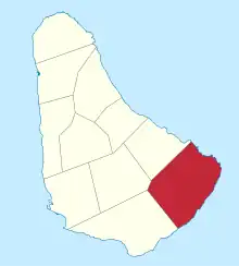 Map of Barbados showing the Saint Philip parish | |
| Coordinates: 13°07′N 59°28′W | |
| Country | Barbados |
| Largest city | Six Cross Roads |
| Government | |
| • Type | Parliamentary democracy |
| • Parliamentry seats | 3 |
| Area | |
| • Total | 60 km2 (23.17 sq mi) |
| Population (2010 census) | |
| • Total | 30,662 |
| • Density | 510/km2 (1,300/sq mi) |
| ISO 3166 code | BB-10[1] |
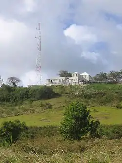
St. Philip has the largest land area of the 11 parishes of Barbados. It has a mostly flat 'close to sea-level' land. It does not have a true city, rather villages and areas.
This parish is home to the only 'dependency' of Barbados called Culpepper Island. This tiny rock in the ocean is used as a feeding ground for sheep. It cannot be reached unless by boat or by foot at low tide.
References
- iso:code:3166:BB, International Organization for Standardization
This article is issued from Wikipedia. The text is licensed under Creative Commons - Attribution - Sharealike. Additional terms may apply for the media files.