Sabirabad (city)
Sabirabad city
Sabirabad şəhəri | |
|---|---|
 | |
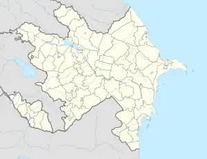 Sabirabad city Location in Sabirabad District and Azerbaijan | |
| Coordinates: 40°00′46″N 48°28′44″E | |
| Country | |
| Rayon | Sabirabad |
| Established date | 1888 |
| Government | |
| • City executive representative | Ahadagha Aliyev |
| Area | |
| • Total | 1,246 km2 (481 sq mi) |
| Elevation | −12 m (−39 ft) |
| Population (2018) | |
| • Total | 30,612 |
| • Density | 2,460/km2 (6,400/sq mi) |
| • Population Rank in Azerbaijan | 21st |
| Time zone | UTC+4 (AZT) |
| Area code | +994 21 |
| Vehicle registration | 54 AZ |
| Website | sabirabad-ih.gov.az |
Sabirabad (also, Galagayin, Petropavlovka, Petropavlovskoye, and Sabirabad) is a city in and the capital of the Sabirabad Rayon of Azerbaijan. The city was renamed in honor of the poet Mirza Alekper Sabir.[1]
Sabirabad - administrative center of Sabirabad District of the Republic of Azerbaijan. In 1935, the district received the status of subordinate city.
Sabirabad is located on the right bank of the Kura River. In the vicinity of the city called Sugovushan, the Araz River is merged with the Kur River.
References
- Gateway Azerbaijan Archived 2004-11-15 at Archive.today
Other websites
- Sabirabad at GEOnet Names Server
- World Gazetteer: Azerbaijan – World-Gazetteer.com
This article is issued from Wikipedia. The text is licensed under Creative Commons - Attribution - Sharealike. Additional terms may apply for the media files.