Sabana Larga, Elías Piña
Sabana Larga (in English, "Long Savanna") is a Dominican municipal district of Comendador in the Elías Piña Province near the border with Haiti.
Sabana Larga | |
|---|---|
 Sabana Larga | |
| Coordinates: 18°56′38″N 71°39′26″W | |
| Country | |
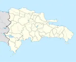
| Province | Elías Piña |
| Municipality | Comendador |
| Municipal District since | 2004 |
| Area | |
| • Total | 101.1 km2 (39.0 sq mi) |
| Elevation | 327 m (1,073 ft) |
| Population (2010)[1] | |
| • Total | 2,056 |
| • Density | 20/km2 (53/sq mi) |
| • Urban | 527 |
| Time zone | UTC-4 (AST) |
| • Summer (DST) | UTC-4 (AST) |
Population
The municipality had, in 2010, a total population of 2,056: 1,127 men and 929 women. The urban population was 25.6% of the total population.[1]
History
Sabana Larga was made a municipal district of Comendador by the law 18 of 20 January 2004;[3] a municipal district is a part of a municipality that has its own government.
Geography
Sabana Larga is to the northeast of the city of Comendador, on the northern side of the Macasías river, the main left tributary of the Artibonite river.
Economy
The main economic activity of Sabana Larga is farming.
References
- "IX Censo Nacional de Población y Vivienda. Informe Básico" (PDF) (in Spanish). Oficina Nacional de Estadística. June 2012. Retrieved 13 October 2016.
- "Provincia de Elías Piña". Geonames.org. Retrieved 13 October 2016.
- Féliz, Werner D. (2004). División Político-Territorial Dominicana 1944-2004 (in Spanish). Santo Domingo: CONAU.
This article is issued from Wikipedia. The text is licensed under Creative Commons - Attribution - Sharealike. Additional terms may apply for the media files.