Pardubice Region
Pardubice Region is an administrative unit (kraj) of the Czech Republic. The capital city is Pardubice.
Pardubice Region
Pardubický kraj | |
|---|---|
Region | |
 Kunětická Hora from air | |
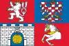 Flag 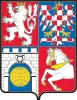 Coat of arms | |
 | |
| Coordinates: 49°52′N 16°10′E | |
| Country | Czech Republic |
| Capital | Pardubice |
| Area | |
| • Total | 4,518.63 km2 (1,744.65 sq mi) |
| Highest elevation | 1,424 m (4,672 ft) |
| Population (2019-01-01[1]) | |
| • Total | 520,316 |
| • Density | 120/km2 (300/sq mi) |
| ISO 3166 code | CZ-PA |
| Vehicle registration | E |
| Website | www.pardubickykraj.cz |
Králický Sněžník (1,424 m) is the highest point in the region. The European Watershed runs through the region, where it separates the basins of the North Sea and the Black Sea.
Administrative divisions
The Pardubice Region is divided into 4 districts:
 | ||||||||||
Districts of Pardubice Region
| ||||||||||
Places of interest
- National Breeding Stud at Kladruby nad Labem
- Králíky and Králický Sněžník National Nature Reserve
- Kunětická Hora Castle
- Lanškroun Pond Nature Park
- Letohrad and its Museum of Crafts
- Litomyšl with the Renaissance Chateau
- Nové Hrady Chateau
- Pardubice with the Pardubice Chateau and Grand Pardubice Steeplechase
- Svojanov Castle
- Veselý Kopec, the largest collection of folk architecture in Bohemia
References
- "Population of territorial units of the Czech republic". Czech Statistical Office. Retrieved 2019-04-30.
Wikimedia Commons has media related to Pardubice Region.
This article is issued from Wikipedia. The text is licensed under Creative Commons - Attribution - Sharealike. Additional terms may apply for the media files.