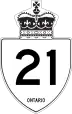
Ontario Highway 21
Ontario Highway 21, also called King's Highway 21, is a provincial highway in southwestern Ontario, Canada. It starts near Ontario Highway 402, almost half way between Sarnia and London. It runs north/northeast for 227 kilometres (141 mi) and ends in Owen Sound with Highway 6, Highway 10, and Highway 26.[2] The roadway is referred to as the Bluewater Highway because it remains very close to the eastern shoreline of Lake Huron.[3] It was started in 1927 as Highway 3 running across Kent and Lambton Counties.[2] In 1930 it was extended and renamed King's Highway 21.[2] It is one of Ontario's most treacherous roads for winter driving. Highway 21 is frequently closed during winter because of snow blowing off Lake Huron.[4]
Highway 21 | |||||||
|---|---|---|---|---|---|---|---|
| Bluewater Highway | |||||||
Highway 21 highlighted in red | |||||||
| Route information | |||||||
| Maintained by the Ministry of Transportation of Ontario | |||||||
| Length | 226.8 km (140.9 mi) | ||||||
| Existed | May 23, 1927[1]–present | ||||||
| Major junctions | |||||||
| South end | |||||||
| North end | |||||||
| Location | |||||||
| Country | Canada | ||||||
| Province | Ontario | ||||||
| Major cities | Grand Bend, Goderich, Kincardine, Southampton, Port Elgin, Owen Sound | ||||||
| Highway system | |||||||
| |||||||
| |||||||
| |||||||
References
- Whipp 1983, p. 31.
- Cameron Bevers (n.d.). "History of King's Highway 21". The King's Highway.ca. Retrieved October 12, 2014.
- Alan Tucker, The Penguin Guide to Canada (New York: Penguin, 1989), p. 50
- Henry Stancu (December 11, 2012). "Ontario's 10 toughest winter roads". Wheels.ca. Retrieved October 12, 2014.
This article is issued from Wikipedia. The text is licensed under Creative Commons - Attribution - Sharealike. Additional terms may apply for the media files.