Oconee County, South Carolina
Oconee County is the westernmost county in the U.S. state of South Carolina. As of the 2020 census, the population was 78,607.[2] Its county seat is Walhalla.[3]
Oconee County | |
|---|---|
 Oconee County Courthouse in Walhalla | |
 Flag | |
| Nickname: Land Beside The Water | |
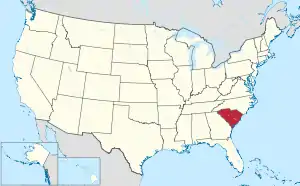
 Location within the U.S. state of South Carolina | |
 South Carolina's location within the U.S. | |
| Coordinates: 34°44′56″N 83°03′42″W | |
| Country | |
| State | |
| Founded | 1868 |
| Named for | Cherokee word for "land beside the water" [1] |
| Seat | Walhalla |
| Largest community | Seneca |
| Area | |
| • Total | 673.57 sq mi (1,744.5 km2) |
| • Land | 626.56 sq mi (1,622.8 km2) |
| • Water | 47.01 sq mi (121.8 km2) 6.98% |
| Population (2020) | |
| • Total | 78,607 |
| • Density | 125.46/sq mi (48.44/km2) |
| Time zone | UTC−5 (Eastern) |
| • Summer (DST) | UTC−4 (EDT) |
| Congressional district | 3rd |
| Website | www |
References
- "History Of Oconee County". www.oconeelibrary.org. Archived from the original on December 26, 2022. Retrieved June 13, 2022.
- "QuickFacts: Oconee County, South Carolina". United States Census Bureau. Retrieved January 20, 2024.
- "Find a County". National Association of Counties. Retrieved 2011-06-07.
This article is issued from Wikipedia. The text is licensed under Creative Commons - Attribution - Sharealike. Additional terms may apply for the media files.