Miranda (state)
Estado Miranda is one of the 23 states of Venezuela. The state capital is Los Teques.[1][2]
.svg.png.webp)
Location within Venezuela

Flag

coat of arms
Miranda State covers a total surface area of 7,950 km². It is the second largest state in population after Zulia Venezuela, approximately 3,028,965 (2011).
Administrative divisions
Municipalities and municipal seats
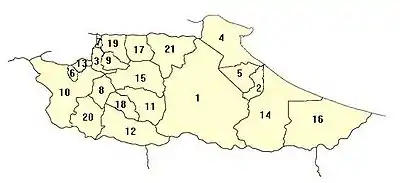
Municipalities in Miranda
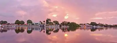
Dawn at Puerto Encantado, Higuerote.
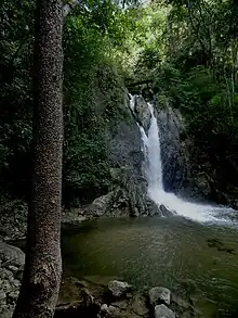
La Llovizna Falls, Guatire
Miranda state is sub-divided into 21 municipalities,.[2] given below with their areas, populations and administrative seats:
| Municipality | Area (km2) | Population (Census 2001) | Seat | |
|---|---|---|---|---|
| 1. | Acevedo | 1,879 | 70,282 | Caucagua |
| 2. | Andrés Bello | 114 | 20,119 | San José de Barlovento |
| 3. | Baruta | 86 | 260,853 | Nuestra Señora del Rosario de Baruta |
| 4. | Brión | 531 | 45,346 | Higuerote |
| 5. | Buroz | 198 | 20,009 | Mamporal |
| 6. | Carrizal | 32 | 41,103 | Carrizal |
| 7. | Chacao | 13 | 64,629 | Chacao |
| 8. | Cristóbal Rojas | 120 | 77,257 | Charallave |
| 9. | El Hatillo | 81 | 54,225 | El Hatillo |
| 10. | Guaicaipuro | 661 | 222,768 | Los Teques |
| 11. | Independencia | 284 | 126,999 | Santa Teresa del Tuy |
| 12. | Lander | 478 | 108,970 | Ocumare del Tuy |
| 13. | Los Salias | 51 | 60,723 | San Antonio de los Altos |
| 14. | Páez | 963 | 30,812 | Río Chico |
| 15. | Paz Castillo | 408 | 83,976 | Santa Lucía |
| 16. | Pedro Gual | 925 | 17,928 | Cúpira |
| 17. | Plaza | 180 | 188,135 | Guarenas |
| 18. | Simón Bolívar | 131 | 31,944 | San Francisco de Yare |
| 19. | Sucre | 164 | 546,766 | Petare |
| 20. | Urdaneta | 273 | 105,606 | Cúa |
| 21. | Zamora | 378 | 152,422 | Guatire |
Other important towns
|
|
|
Geography
Rivers
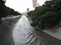
Guaire river
El principal río del estado es el río Tuy. Nace a 2.100 m de altitud y recorre de 250 km.[2][3] Otros ris del estado son: Guaire, Grande, Curiepe, Capaya, Guapo, Chupaquire, Panapo, Uchire, Chuspa and Aricagua.
Lagoons
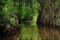
Tacarigua Lagoon
In the state there are various gaps: Laguna de Tacarigua, Merecuere, Agua salud, El Conflicto y el Rosario.[2][3]
National parks

Pozo Araguaichú. Norte river in El Ávila National Park
- El Ávila National Park.
- Guatopo National Park.
- Laguna de Tacarigua National Park.
- Macarao National Park.
Natural monuments
- Cueva Alfredo Jahn.
- Pico Codazzi.
- Cuevas del Indio Park.
Other sites of interest
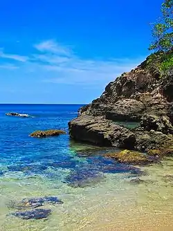
Higuerote beach
- Acuario Agustín Codazzi.
- Birongo.
- El Pueblo El Jarillo.
- Higuerote.
- Playa de Carenero.
- Playa de Chirimena.
- Playas de Barlovento.
- Playas de Buche y Los Totumos.
- Puerto Francés.
- Tren El Encanto.
References
- Franceschi, Napoleón. 1986: Distrito Federal y Estado Miranda geografía, historia y folklore. Colegial Bolivariana, C.A. Caracas. 239p. ISBN 980-262-234-6
- Hernández Caballero, Serafín (Editor). (1998): Gran Enciclopedia de Venezuela. Editorial Globe, C.A. Caracas. 10 volúmenes. ISBN 980-6427-00-9 ISBN 980-6427-10-6
- Vila, Marco Aurelio, 1967: Aspectos geográficos del estado Miranda. Corporación Venezolana de Fomento. Caracas. 327p.
Other websites
Wikimedia Commons has media related to Miranda (state).
- Gobernación del Estado Miranda
- Instituto Autónomo de Bibliotecas e Información del Estado Miranda Archived 2014-03-03 at the Wayback Machine
- Estación Meteorológica de los altos mirandinos Archived 2011-05-11 at the Wayback Machine
- Information about the region of the Tuy Valley Archived 2008-08-10 at the Wayback Machine
- Notices about the region of Barlovento at Barloventoardiente.com Archived 2009-02-09 at the Wayback Machine
- Guatire.net
- Guarenas.com
This article is issued from Wikipedia. The text is licensed under Creative Commons - Attribution - Sharealike. Additional terms may apply for the media files.