Meadow Vale, Kentucky
Meadow Vale is a city of Kentucky in the United States. It is in Jefferson County.
Meadow Vale, Kentucky | |
|---|---|
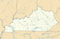 Meadow Vale Location within the state of Kentucky  Meadow Vale Meadow Vale (the United States) | |
| Coordinates: 38°17′00″N 85°34′21″W | |
| Country | United States |
| State | Kentucky |
| County | Jefferson |
| Incorporated | 1967[1] |
| Area | |
| • Total | 0.22 sq mi (0.57 km2) |
| • Land | 0.22 sq mi (0.57 km2) |
| • Water | 0.00 sq mi (0.00 km2) |
| Elevation | 659 ft (201 m) |
| Population | |
| • Total | 730 |
| • Density | 3,333.33/sq mi (1,288.95/km2) |
| Time zone | UTC-5 (Eastern (EST)) |
| • Summer (DST) | UTC-4 (EDT) |
| ZIP Code | 40242 |
| FIPS code | 21-51258 |
| GNIS feature ID | 2405057[3] |
| Website | cityofmeadowvale |
References
- Commonwealth of Kentucky. Office of the Secretary of State. Land Office. "Meadow Vale, Kentucky". Accessed 26 August 2013.
- "2020 U.S. Gazetteer Files". United States Census Bureau. Retrieved March 18, 2022.
- U.S. Geological Survey Geographic Names Information System: Meadow Vale, Kentucky
- "Meadow Vale city, Kentucky". United States Census Bureau. Retrieved November 13, 2023.
This article is issued from Wikipedia. The text is licensed under Creative Commons - Attribution - Sharealike. Additional terms may apply for the media files.