Manica Province
Manica | |
|---|---|
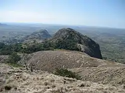 Looking down from Mount Zembe | |
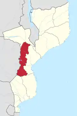 Manica, Province of Mozambique | |
| Country | Mozambique |
| Capital | Chimoio |
| Area | |
| • Total | 62,272 km2 (24,043 sq mi) |
| Highest elevation | 2,436 m (7,992 ft) |
| Population (2017 census) | |
| • Total | 1,945,994 |
| • Density | 31/km2 (81/sq mi) |
| [1] | |
| Postal code | 22xx |
| Area code | (+258) 251 |
| Website | www |
Manica is a province of Mozambique. The capital city is Chimoio.
The Save River creates the southern border. There is also the Zambezi river in the northeast. The highest mountain in Mozambique, Mount Binga (2436 m), is in this province[2] near the border with Zimbabwe.
Districts
Manica Province is divided into 12 districts:
- Báruè District
- Chimoio District
- Gondola District
- Guro District
- Macate District
- Machaze District
- Macossa District
- Manica District
- Mossurize District
- Sussundenga District
- Tambara District
- Vanduzi District
References
- "Estatísticas do Distrito de Bárue. Instituto Nacional de Estatística. Ano 2008" [Statistics District Bárue. National Institute of Statistics. year 2008] (PDF) (in Portuguese). Government of Mozambique. Retrieved 23 September 2014.
- Briggs 2014, p. 221.
This article is issued from Wikipedia. The text is licensed under Creative Commons - Attribution - Sharealike. Additional terms may apply for the media files.