Le Glèbe
Le Glèbe was a municipality of the district Saane in the canton of Fribourg in Switzerland. It was created on 1 January 2003 when the municipalities of Estavayer-le-Gibloux, Rueyres-Saint-Laurent, Villarlod, and Villarsel-le-Gibloux.[1] joined together to become Le Glèbe. On 1 January 2016, the former municipalities of Corpataux-Magnedens, Farvagny, Le Glèbe, Rossens and Vuisternens-en-Ogoz merged to form the new municipality of Gibloux.[2]
Le Glèbe | |
|---|---|
_169.JPG.webp) The chapel of Rueyres-Saint-Laurent | |
 Coat of arms | |
Location of Le Glèbe | |
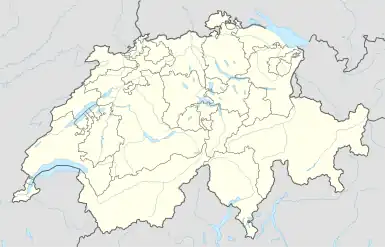 Le Glèbe 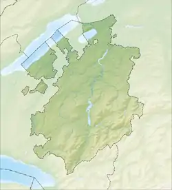 Le Glèbe | |
| Coordinates: 46°43′N 7°2′E | |
| Country | Switzerland |
| Canton | Fribourg |
| District | Saane |
| Government | |
| • Mayor | Syndic |
| Area | |
| • Total | 10.231 km2 (3.950 sq mi) |
| Population (Dec 2014) | |
| • Total | 1,246 |
| • Density | 120/km2 (320/sq mi) |
| Time zone | UTC+01:00 (Central European Time) |
| • Summer (DST) | UTC+02:00 (Central European Summer Time) |
| Postal code(s) | 1695 |
| SFOS number | 2223 |
| Localities | Estavayer-le-Gibloux, Rueyres-Saint-Laurent, Villarlod, Villarsel-le-Gibloux |
| Surrounded by | Autigny, Farvagny, Pont-en-Ogoz, Sorens, Villorsonnens, Vuisternens-en-Ogoz |
| Website | commune-gibloux SFSO statistics |
References
- Amtliches Gemeindeverzeichnis der Schweiz published by the Swiss Federal Statistical Office (in German) accessed 19 July 2011
- Amtliches Gemeindeverzeichnis der Schweiz published by the Swiss Federal Statistical Office (in German) accessed 19 January 2016
This article is issued from Wikipedia. The text is licensed under Creative Commons - Attribution - Sharealike. Additional terms may apply for the media files.