Laragne-Montéglin
Laragne-Montéglin is a commune in the Hautes-Alpes department.
Laragne-Montéglin | |
|---|---|
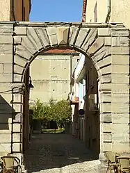 The entrance portal of the remains of the castle of Laragne | |
 Coat of arms | |
Location of Laragne-Montéglin | |
 Laragne-Montéglin 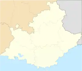 Laragne-Montéglin | |
| Coordinates: 44°18′57″N 5°49′20″E | |
| Country | France |
| Region | Provence-Alpes-Côte d'Azur |
| Department | Hautes-Alpes |
| Arrondissement | Gap |
| Canton | Laragne-Montéglin |
| Government | |
| • Mayor (2008–2014) | Auguste Truphème |
| Area 1 | 23.51 km2 (9.08 sq mi) |
| Population | 3,543 |
| • Density | 150/km2 (390/sq mi) |
| Time zone | UTC+01:00 (CET) |
| • Summer (DST) | UTC+02:00 (CEST) |
| INSEE/Postal code | 05070 /05300 |
| Elevation | 544–1,240 m (1,785–4,068 ft) (avg. 573 m or 1,880 ft) |
| 1 French Land Register data, which excludes lakes, ponds, glaciers > 1 km2 (0.386 sq mi or 247 acres) and river estuaries. | |
Population
| Year | Pop. | ±% |
|---|---|---|
| 1962 | 2,998 | — |
| 1968 | 3,579 | +19.4% |
| 1975 | 3,847 | +7.5% |
| 1982 | 3,647 | −5.2% |
| 1990 | 3,371 | −7.6% |
| 1999 | 3,296 | −2.2% |
| 2008 | 3,532 | +7.2% |
Transport
Road
The D122, D422, D942 and D1075 (E712) roads pass through the commune.
Rail
Laragne-Montéglin has a train station called Gare de Laragne.[2]
Geography
The Buëch river passes through the commune.
Location
The commune borders the Alpes-de-Haute-Provence department.
References
- "Populations légales 2019". The National Institute of Statistics and Economic Studies. 29 December 2021.
- "TER Sud-Provence-Alpes-Côte d'Azur - Horaires et informations pratiques au départ de la gare de Laragne". www.ter.sncf.com. Archived from the original on 2021-05-15. Retrieved 2021-01-22.
This article is issued from Wikipedia. The text is licensed under Creative Commons - Attribution - Sharealike. Additional terms may apply for the media files.