Lake Neusiedl
Lake Neusiedl is the second largest steppe lake in Central Europe. It goes across the Austrian and Hungarian border. The lake covers 315 km². 240 km² is on the Austrian side and 75 km² on the Hungarian side. The lake's drainage basin has an area of about 1,120 km². From north to south, the lake is about 36 km long. It is between 6 km and 12 km wide from east to west. The lake is no more than 1.8 m deep.
| Neusiedler See Fertő tó | |
|---|---|
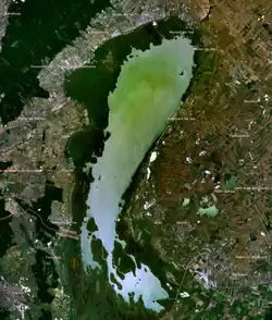 Satellite image of Lake Neusiedl | |
| Location | Austria, Hungary |
| Coordinates | 47°50′N 16°45′E |
| Type | Endorheic lake |
| Primary inflows | precipitation, Wulka |
| Primary outflows | evaporation (90%) Einserkanal (artificial) |
| Catchment area | 1,120 km2 (430 sq mi) |
| Basin countries | Austria, Hungary |
| Max. length | 36 km (22 mi) |
| Max. width | 12 km (7.5 mi) |
| Surface area | 315 km2 (122 sq mi) |
| Average depth | 1 m (3 ft 3 in) |
| Max. depth | 1.8 m (5 ft 11 in) |
| Water volume | 0.325 km3 (0.078 cu mi) |
| Surface elevation | 115.45 m (378.8 ft) |
| Settlements | Neusiedl am See, Rust |
| Official name | Fertő/Neusiedlersee Cultural Landscape |
| Type | Cultural |
| Criteria | v |
| Designated | 2001 (25th session) |
| Reference no. | 772 |
| State Party | Austria and Hungary |
| Region | Europe and North America |
Most of the lake is surrounded by reeds which serve as a home for animals. The lake is an important resting place for migratory birds.
In 2001 the national parks in Austria and Fertő-Hanság in Hungary were together accepted as a World Heritage Site.[1]
This article is issued from Wikipedia. The text is licensed under Creative Commons - Attribution - Sharealike. Additional terms may apply for the media files.