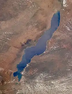
Lake Malawi
Lake Malawi (or Lake Nyasa, Lake Niassa) is a lake in Africa. It is the southernmost lake in the East African Rift system. It is shared between Malawi, Mozambique and Tanzania. Before Malawi became independent in 1964, the territory was called Nyasaland. For this reason, Mozambique and Tanzania call the lake Lake Nyasa.
| Lake Malawi | |
|---|---|
 View from orbit | |
| Coordinates | 12°11′S 34°22′E |
| Type | Rift lake |
| Primary inflows | Ruhuhu River |
| Primary outflows | Shire River |
| Basin countries | Malawi, Mozambique, Tanzania |
| Max. width | 75 km |
| Surface area | 29,600 km2 (11,400 sq mi) |
| Average depth | 292 m |
| Max. depth | 706 m |
| Water volume | 8,400 km³ |
| Surface elevation | 500 meters above sea level |
| Islands | Likoma and Chizumulu islets |
Lake Malawi is the third largest and second deepest lake in Africa. It is the ninth largest lake in the world.
This article is issued from Wikipedia. The text is licensed under Creative Commons - Attribution - Sharealike. Additional terms may apply for the media files.