Laghouat Province
Laghouat is a province (wilaya) in central Algeria. The name means "the oases". The capital is Laghouat. Other localities include Aflou, Ain Madhi, Kourdane and Makhareg.
Laghouat Province
ولاية الأغواط | |
|---|---|
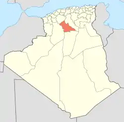 Map of Algeria highlighting Laghouat | |
| Coordinates: 33°48′N 2°53′E | |
| Country | Algeria |
| Capital | Laghouat |
| Area | |
| • Total | 25,057 km2 (9,675 sq mi) |
| Population (2008)[1] | |
| • Total | 477,328 |
| • Density | 19/km2 (49/sq mi) |
| Time zone | UTC+01 (CET) |
| Area Code | +213 (0) 29 |
| ISO 3166 code | DZ-03 |
| Districts | 10 |
| Municipalities | 24 |
Divisions
The province is divided into 10 districts. There are also 24 communes or municipalities.
Districts
- Aflou
- Aïn Mahdi
- Brida
- El Ghicha
- Gueltet Sidi Saâd
- Hassi R'Mel
- Ksar El Hirane
- Laghouat
- Oued Morra
- Sidi Makhlouf
References
- Office National des Statistiques, Recensement General de la Population et de l’Habitat 2008 Preliminary results of the 2008 population census. Accessed on 2008-07-02.
This article is issued from Wikipedia. The text is licensed under Creative Commons - Attribution - Sharealike. Additional terms may apply for the media files.