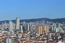
Kartal
Kartal is a district of Istanbul, Turkey. It is located on the Asian side of the city. It is on the coast of the Marmara Sea between Maltepe and Pendik. Its total area is 38.54 square kilometres (14.88 sq mi).[1] It has a population of nearly 500,0000 people.[1]
Kartal | |
|---|---|
district | |
 Kartal Municipality Emblem | |
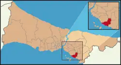 Location of Kartal in Istanbul | |
 Kartal | |
| Coordinates: 40°54′39″N 29°09′42″E | |
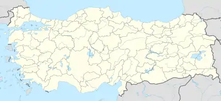
| Country | Turkey |
| City | Istanbul |
| Settled | 6th century |
| Government | |
| • Mayor | Altınok Öz (CHP) |
| • Governor | Hasan Bağcı |
| Time zone | UTC+2 (EET) |
| • Summer (DST) | UTC+3 (EEST) |
| Area code | 0-216 |
| Website | www www |
Kartal behind the coast the land rises sharply up to Yakacık Hill ("the balcony of Istanbul") and Aydos, on these hills the land is fertile.[2] Kartal has a mild climate.[3]
References
- "About Kartal". Kartal Municipality. Archived from the original on 12 May 2015. Retrieved 2 January 2015.
- What is the highest point of Istanbul? Kartal 24
- Volkan Altay; et al., 'Urban flora and ecological characteristics of the Kartal District (Istanbul)', Scientific Research and Essay, Vol. 5(2) (18 January, 2010) p. 185
This article is issued from Wikipedia. The text is licensed under Creative Commons - Attribution - Sharealike. Additional terms may apply for the media files.